You are here: Home > Network List > TA - USArray Transportable Network (new EarthScope stations) Stations List
> Station I59A Olmsteadville, NY, USA > Earthquake Result Viewer
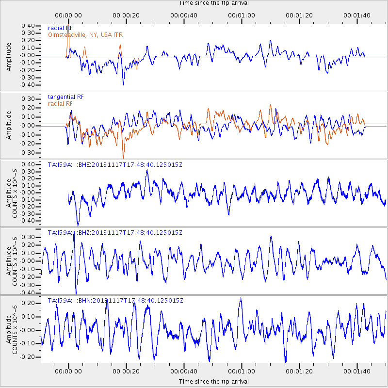
I59A Olmsteadville, NY, USA - Earthquake Result Viewer
*The percent match for this event was below the threshold and hence no stack was calculated.
| Earthquake location: |
Ascension Island Region |
| Earthquake latitude/longitude: |
-10.3/-11.8 |
| Earthquake time(UTC): |
2013/11/17 (321) 17:37:14 GMT |
| Earthquake Depth: |
10 km |
| Earthquake Magnitude: |
5.5 MB, 5.4 MWC |
| Earthquake Catalog/Contributor: |
NEIC PDE/NEIC COMCAT |
|
| Network: |
TA USArray Transportable Network (new EarthScope stations) |
| Station: |
I59A Olmsteadville, NY, USA |
| Lat/Lon: |
43.80 N/73.87 W |
| Elevation: |
390 m |
|
| Distance: |
77.8 deg |
| Az: |
319.128 deg |
| Baz: |
117.226 deg |
| Ray Param: |
$rayparam |
*The percent match for this event was below the threshold and hence was not used in the summary stack. |
|
| Radial Match: |
48.391075 % |
| Radial Bump: |
400 |
| Transverse Match: |
48.04268 % |
| Transverse Bump: |
400 |
| SOD ConfigId: |
626651 |
| Insert Time: |
2014-04-19 16:56:26.043 +0000 |
| GWidth: |
2.5 |
| Max Bumps: |
400 |
| Tol: |
0.001 |
|
Signal To Noise
| Channel | StoN | STA | LTA |
| TA:I59A: :BHZ:20131117T17:48:40.125015Z | 1.5014257 | 1.967844E-7 | 1.3106502E-7 |
| TA:I59A: :BHN:20131117T17:48:40.125015Z | 1.3568652 | 1.04756616E-7 | 7.720489E-8 |
| TA:I59A: :BHE:20131117T17:48:40.125015Z | 1.1660544 | 1.5746625E-7 | 1.3504193E-7 |
| Arrivals |
| Ps | |
| PpPs | |
| PsPs/PpSs | |


