You are here: Home > Network List > TA - USArray Transportable Network (new EarthScope stations) Stations List
> Station L40A Anamosa, IA, USA > Earthquake Result Viewer
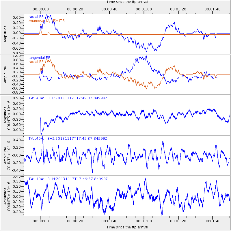
L40A Anamosa, IA, USA - Earthquake Result Viewer
*The percent match for this event was below the threshold and hence no stack was calculated.
| Earthquake location: |
Ascension Island Region |
| Earthquake latitude/longitude: |
-10.3/-11.8 |
| Earthquake time(UTC): |
2013/11/17 (321) 17:37:14 GMT |
| Earthquake Depth: |
10 km |
| Earthquake Magnitude: |
5.5 MB, 5.4 MWC |
| Earthquake Catalog/Contributor: |
NEIC PDE/NEIC COMCAT |
|
| Network: |
TA USArray Transportable Network (new EarthScope stations) |
| Station: |
L40A Anamosa, IA, USA |
| Lat/Lon: |
42.06 N/91.22 W |
| Elevation: |
242 m |
|
| Distance: |
89.1 deg |
| Az: |
312.946 deg |
| Baz: |
104.693 deg |
| Ray Param: |
$rayparam |
*The percent match for this event was below the threshold and hence was not used in the summary stack. |
|
| Radial Match: |
44.178192 % |
| Radial Bump: |
400 |
| Transverse Match: |
37.965782 % |
| Transverse Bump: |
400 |
| SOD ConfigId: |
626651 |
| Insert Time: |
2014-04-19 16:57:30.937 +0000 |
| GWidth: |
2.5 |
| Max Bumps: |
400 |
| Tol: |
0.001 |
|
Signal To Noise
| Channel | StoN | STA | LTA |
| TA:L40A: :BHZ:20131117T17:49:37.84999Z | 1.7410676 | 1.7279946E-7 | 9.9249135E-8 |
| TA:L40A: :BHN:20131117T17:49:37.84999Z | 0.818671 | 2.077076E-7 | 2.5371315E-7 |
| TA:L40A: :BHE:20131117T17:49:37.84999Z | 1.0500528 | 3.295389E-7 | 3.1383078E-7 |
| Arrivals |
| Ps | |
| PpPs | |
| PsPs/PpSs | |


