You are here: Home > Network List > TA - USArray Transportable Network (new EarthScope stations) Stations List
> Station Q51A Peebles, OH, USA > Earthquake Result Viewer
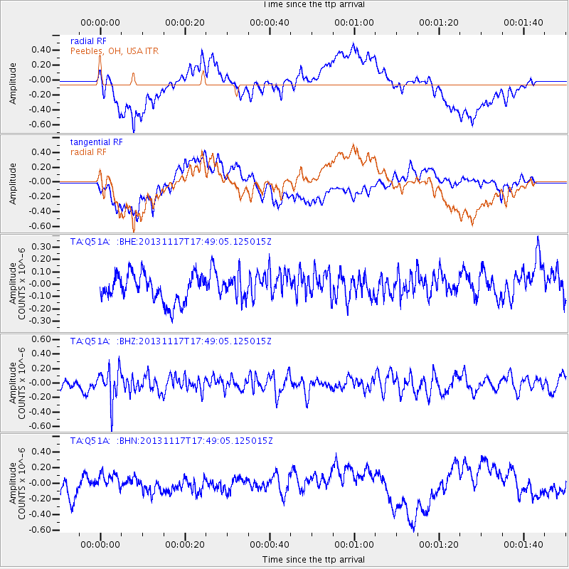
Q51A Peebles, OH, USA - Earthquake Result Viewer
*The percent match for this event was below the threshold and hence no stack was calculated.
| Earthquake location: |
Ascension Island Region |
| Earthquake latitude/longitude: |
-10.3/-11.8 |
| Earthquake time(UTC): |
2013/11/17 (321) 17:37:14 GMT |
| Earthquake Depth: |
10 km |
| Earthquake Magnitude: |
5.5 MB, 5.4 MWC |
| Earthquake Catalog/Contributor: |
NEIC PDE/NEIC COMCAT |
|
| Network: |
TA USArray Transportable Network (new EarthScope stations) |
| Station: |
Q51A Peebles, OH, USA |
| Lat/Lon: |
39.03 N/83.35 W |
| Elevation: |
362 m |
|
| Distance: |
82.5 deg |
| Az: |
311.826 deg |
| Baz: |
109.717 deg |
| Ray Param: |
$rayparam |
*The percent match for this event was below the threshold and hence was not used in the summary stack. |
|
| Radial Match: |
64.61417 % |
| Radial Bump: |
400 |
| Transverse Match: |
59.717506 % |
| Transverse Bump: |
400 |
| SOD ConfigId: |
626651 |
| Insert Time: |
2014-04-19 16:59:38.448 +0000 |
| GWidth: |
2.5 |
| Max Bumps: |
400 |
| Tol: |
0.001 |
|
Signal To Noise
| Channel | StoN | STA | LTA |
| TA:Q51A: :BHZ:20131117T17:49:05.125015Z | 3.8898313 | 2.2220044E-7 | 5.7123415E-8 |
| TA:Q51A: :BHN:20131117T17:49:05.125015Z | 0.95238495 | 1.2697534E-7 | 1.3332355E-7 |
| TA:Q51A: :BHE:20131117T17:49:05.125015Z | 0.81713825 | 9.0794124E-8 | 1.11112314E-7 |
| Arrivals |
| Ps | |
| PpPs | |
| PsPs/PpSs | |


