You are here: Home > Network List > TA - USArray Transportable Network (new EarthScope stations) Stations List
> Station Q55A Buckhannon, WV, USA > Earthquake Result Viewer
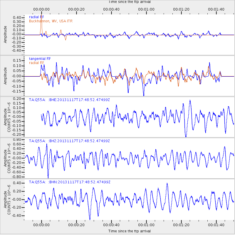
Q55A Buckhannon, WV, USA - Earthquake Result Viewer
*The percent match for this event was below the threshold and hence no stack was calculated.
| Earthquake location: |
Ascension Island Region |
| Earthquake latitude/longitude: |
-10.3/-11.8 |
| Earthquake time(UTC): |
2013/11/17 (321) 17:37:14 GMT |
| Earthquake Depth: |
10 km |
| Earthquake Magnitude: |
5.5 MB, 5.4 MWC |
| Earthquake Catalog/Contributor: |
NEIC PDE/NEIC COMCAT |
|
| Network: |
TA USArray Transportable Network (new EarthScope stations) |
| Station: |
Q55A Buckhannon, WV, USA |
| Lat/Lon: |
39.00 N/80.08 W |
| Elevation: |
657 m |
|
| Distance: |
80.1 deg |
| Az: |
312.711 deg |
| Baz: |
111.898 deg |
| Ray Param: |
$rayparam |
*The percent match for this event was below the threshold and hence was not used in the summary stack. |
|
| Radial Match: |
44.25815 % |
| Radial Bump: |
400 |
| Transverse Match: |
44.522427 % |
| Transverse Bump: |
400 |
| SOD ConfigId: |
626651 |
| Insert Time: |
2014-04-19 16:59:48.616 +0000 |
| GWidth: |
2.5 |
| Max Bumps: |
400 |
| Tol: |
0.001 |
|
Signal To Noise
| Channel | StoN | STA | LTA |
| TA:Q55A: :BHZ:20131117T17:48:52.47499Z | 2.4726965 | 3.633642E-7 | 1.4695058E-7 |
| TA:Q55A: :BHN:20131117T17:48:52.47499Z | 1.2208291 | 1.1676252E-7 | 9.564198E-8 |
| TA:Q55A: :BHE:20131117T17:48:52.47499Z | 0.95120704 | 4.9352007E-8 | 5.188356E-8 |
| Arrivals |
| Ps | |
| PpPs | |
| PsPs/PpSs | |


