You are here: Home > Network List > TA - USArray Transportable Network (new EarthScope stations) Stations List
> Station V55A Taylorsville, NC, USA > Earthquake Result Viewer
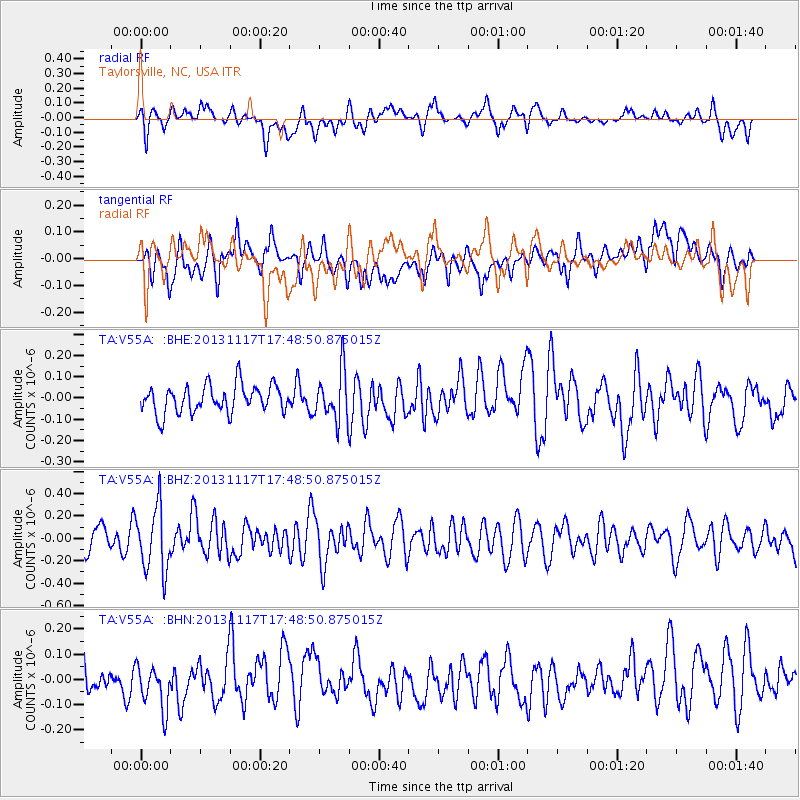
V55A Taylorsville, NC, USA - Earthquake Result Viewer
*The percent match for this event was below the threshold and hence no stack was calculated.
| Earthquake location: |
Ascension Island Region |
| Earthquake latitude/longitude: |
-10.3/-11.8 |
| Earthquake time(UTC): |
2013/11/17 (321) 17:37:14 GMT |
| Earthquake Depth: |
10 km |
| Earthquake Magnitude: |
5.5 MB, 5.4 MWC |
| Earthquake Catalog/Contributor: |
NEIC PDE/NEIC COMCAT |
|
| Network: |
TA USArray Transportable Network (new EarthScope stations) |
| Station: |
V55A Taylorsville, NC, USA |
| Lat/Lon: |
35.85 N/81.21 W |
| Elevation: |
306 m |
|
| Distance: |
79.8 deg |
| Az: |
309.408 deg |
| Baz: |
110.633 deg |
| Ray Param: |
$rayparam |
*The percent match for this event was below the threshold and hence was not used in the summary stack. |
|
| Radial Match: |
49.512486 % |
| Radial Bump: |
400 |
| Transverse Match: |
52.19739 % |
| Transverse Bump: |
400 |
| SOD ConfigId: |
626651 |
| Insert Time: |
2014-04-19 17:01:57.225 +0000 |
| GWidth: |
2.5 |
| Max Bumps: |
400 |
| Tol: |
0.001 |
|
Signal To Noise
| Channel | StoN | STA | LTA |
| TA:V55A: :BHZ:20131117T17:48:50.875015Z | 2.5683558 | 2.857107E-7 | 1.1124264E-7 |
| TA:V55A: :BHN:20131117T17:48:50.875015Z | 1.1750051 | 9.531201E-8 | 8.111626E-8 |
| TA:V55A: :BHE:20131117T17:48:50.875015Z | 1.7749524 | 1.1543497E-7 | 6.503553E-8 |
| Arrivals |
| Ps | |
| PpPs | |
| PsPs/PpSs | |


