You are here: Home > Network List > TA - USArray Transportable Network (new EarthScope stations) Stations List
> Station X51A Calhoun, GA, USA > Earthquake Result Viewer
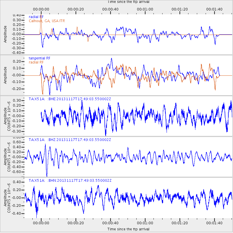
X51A Calhoun, GA, USA - Earthquake Result Viewer
*The percent match for this event was below the threshold and hence no stack was calculated.
| Earthquake location: |
Ascension Island Region |
| Earthquake latitude/longitude: |
-10.3/-11.8 |
| Earthquake time(UTC): |
2013/11/17 (321) 17:37:14 GMT |
| Earthquake Depth: |
10 km |
| Earthquake Magnitude: |
5.5 MB, 5.4 MWC |
| Earthquake Catalog/Contributor: |
NEIC PDE/NEIC COMCAT |
|
| Network: |
TA USArray Transportable Network (new EarthScope stations) |
| Station: |
X51A Calhoun, GA, USA |
| Lat/Lon: |
34.57 N/84.86 W |
| Elevation: |
214 m |
|
| Distance: |
82.2 deg |
| Az: |
307.18 deg |
| Baz: |
108.192 deg |
| Ray Param: |
$rayparam |
*The percent match for this event was below the threshold and hence was not used in the summary stack. |
|
| Radial Match: |
52.631527 % |
| Radial Bump: |
400 |
| Transverse Match: |
48.37639 % |
| Transverse Bump: |
400 |
| SOD ConfigId: |
626651 |
| Insert Time: |
2014-04-19 17:02:34.370 +0000 |
| GWidth: |
2.5 |
| Max Bumps: |
400 |
| Tol: |
0.001 |
|
Signal To Noise
| Channel | StoN | STA | LTA |
| TA:X51A: :BHZ:20131117T17:49:03.550002Z | 2.2345974 | 3.1217476E-7 | 1.3970067E-7 |
| TA:X51A: :BHN:20131117T17:49:03.550002Z | 0.92442274 | 8.7112404E-8 | 9.423438E-8 |
| TA:X51A: :BHE:20131117T17:49:03.550002Z | 0.96237475 | 9.251862E-8 | 9.613575E-8 |
| Arrivals |
| Ps | |
| PpPs | |
| PsPs/PpSs | |


