You are here: Home > Network List > IW - Intermountain West Stations List
> Station DLMT Dillon, Montana, USA > Earthquake Result Viewer
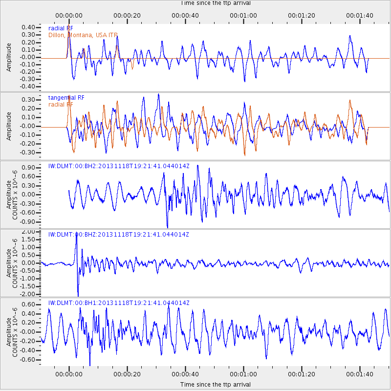
DLMT Dillon, Montana, USA - Earthquake Result Viewer
*The percent match for this event was below the threshold and hence no stack was calculated.
| Earthquake location: |
Near S. Coast Of Honshu, Japan |
| Earthquake latitude/longitude: |
34.3/137.0 |
| Earthquake time(UTC): |
2013/11/18 (322) 19:10:45 GMT |
| Earthquake Depth: |
328 km |
| Earthquake Magnitude: |
5.6 MWW, 5.7 MWB, 5.7 MWC |
| Earthquake Catalog/Contributor: |
NEIC PDE/NEIC COMCAT |
|
| Network: |
IW Intermountain West |
| Station: |
DLMT Dillon, Montana, USA |
| Lat/Lon: |
45.36 N/112.60 W |
| Elevation: |
1569 m |
|
| Distance: |
78.7 deg |
| Az: |
42.372 deg |
| Baz: |
307.715 deg |
| Ray Param: |
$rayparam |
*The percent match for this event was below the threshold and hence was not used in the summary stack. |
|
| Radial Match: |
56.10769 % |
| Radial Bump: |
400 |
| Transverse Match: |
60.004704 % |
| Transverse Bump: |
400 |
| SOD ConfigId: |
626651 |
| Insert Time: |
2014-04-19 17:19:31.851 +0000 |
| GWidth: |
2.5 |
| Max Bumps: |
400 |
| Tol: |
0.001 |
|
Signal To Noise
| Channel | StoN | STA | LTA |
| IW:DLMT:00:BHZ:20131118T19:21:41.044014Z | 7.2007113 | 7.8683513E-7 | 1.0927186E-7 |
| IW:DLMT:00:BH1:20131118T19:21:41.044014Z | 1.814716 | 2.6716305E-7 | 1.472203E-7 |
| IW:DLMT:00:BH2:20131118T19:21:41.044014Z | 1.7343197 | 4.1468553E-7 | 2.391056E-7 |
| Arrivals |
| Ps | |
| PpPs | |
| PsPs/PpSs | |


