You are here: Home > Network List > IW - Intermountain West Stations List
> Station MOOW Moose Ponds, Wyoming, USA > Earthquake Result Viewer
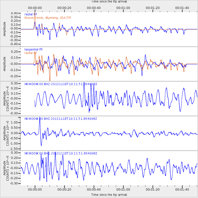
MOOW Moose Ponds, Wyoming, USA - Earthquake Result Viewer
*The percent match for this event was below the threshold and hence no stack was calculated.
| Earthquake location: |
Near S. Coast Of Honshu, Japan |
| Earthquake latitude/longitude: |
34.3/137.0 |
| Earthquake time(UTC): |
2013/11/18 (322) 19:10:45 GMT |
| Earthquake Depth: |
328 km |
| Earthquake Magnitude: |
5.6 MWW, 5.7 MWB, 5.7 MWC |
| Earthquake Catalog/Contributor: |
NEIC PDE/NEIC COMCAT |
|
| Network: |
IW Intermountain West |
| Station: |
MOOW Moose Ponds, Wyoming, USA |
| Lat/Lon: |
43.75 N/110.74 W |
| Elevation: |
2128 m |
|
| Distance: |
80.8 deg |
| Az: |
42.822 deg |
| Baz: |
309.09 deg |
| Ray Param: |
$rayparam |
*The percent match for this event was below the threshold and hence was not used in the summary stack. |
|
| Radial Match: |
67.35855 % |
| Radial Bump: |
344 |
| Transverse Match: |
59.5761 % |
| Transverse Bump: |
323 |
| SOD ConfigId: |
626651 |
| Insert Time: |
2014-04-19 17:19:43.899 +0000 |
| GWidth: |
2.5 |
| Max Bumps: |
400 |
| Tol: |
0.001 |
|
Signal To Noise
| Channel | StoN | STA | LTA |
| IW:MOOW:00:BHZ:20131118T19:21:51.864998Z | 5.718925 | 5.815985E-7 | 1.01697175E-7 |
| IW:MOOW:00:BH1:20131118T19:21:51.864998Z | 1.91792 | 1.14262065E-7 | 5.957603E-8 |
| IW:MOOW:00:BH2:20131118T19:21:51.864998Z | 1.3733187 | 1.2554251E-7 | 9.141542E-8 |
| Arrivals |
| Ps | |
| PpPs | |
| PsPs/PpSs | |


