You are here: Home > Network List > US - United States National Seismic Network Stations List
> Station BOZ Bozeman, Montana, USA > Earthquake Result Viewer
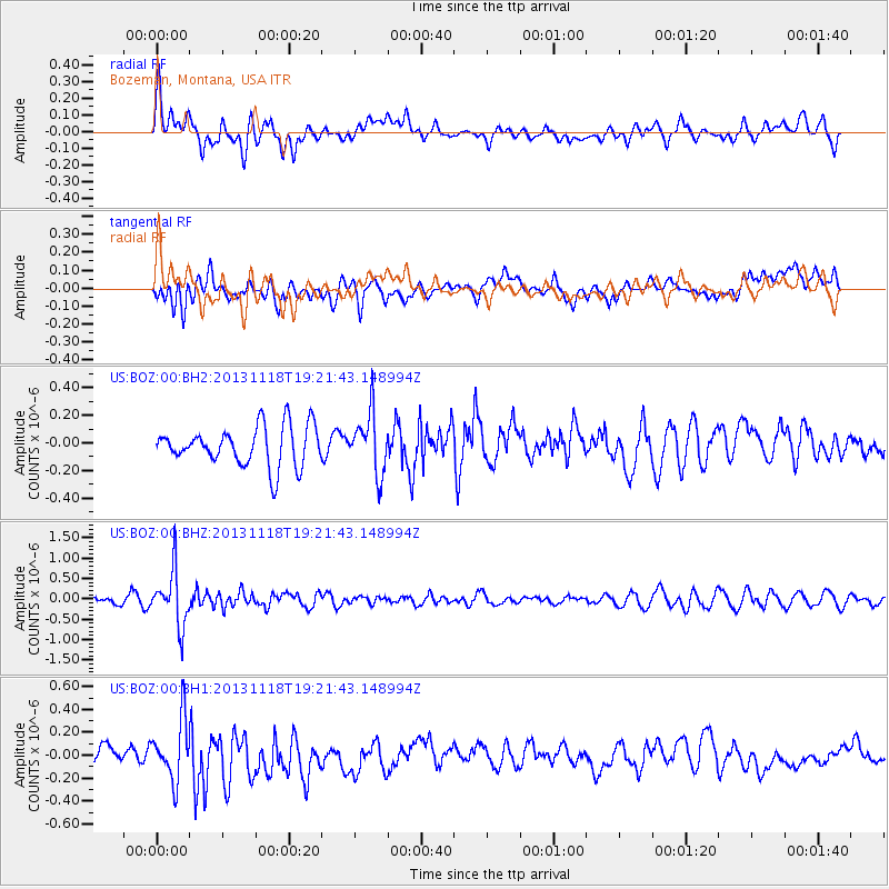
BOZ Bozeman, Montana, USA - Earthquake Result Viewer
*The percent match for this event was below the threshold and hence no stack was calculated.
| Earthquake location: |
Near S. Coast Of Honshu, Japan |
| Earthquake latitude/longitude: |
34.3/137.0 |
| Earthquake time(UTC): |
2013/11/18 (322) 19:10:45 GMT |
| Earthquake Depth: |
328 km |
| Earthquake Magnitude: |
5.6 MWW, 5.7 MWB, 5.7 MWC |
| Earthquake Catalog/Contributor: |
NEIC PDE/NEIC COMCAT |
|
| Network: |
US United States National Seismic Network |
| Station: |
BOZ Bozeman, Montana, USA |
| Lat/Lon: |
45.65 N/111.63 W |
| Elevation: |
1589 m |
|
| Distance: |
79.1 deg |
| Az: |
41.717 deg |
| Baz: |
308.277 deg |
| Ray Param: |
$rayparam |
*The percent match for this event was below the threshold and hence was not used in the summary stack. |
|
| Radial Match: |
44.661377 % |
| Radial Bump: |
400 |
| Transverse Match: |
50.60185 % |
| Transverse Bump: |
400 |
| SOD ConfigId: |
626651 |
| Insert Time: |
2014-04-19 17:31:32.399 +0000 |
| GWidth: |
2.5 |
| Max Bumps: |
400 |
| Tol: |
0.001 |
|
Signal To Noise
| Channel | StoN | STA | LTA |
| US:BOZ:00:BHZ:20131118T19:21:43.148994Z | 8.2752075 | 6.667411E-7 | 8.057092E-8 |
| US:BOZ:00:BH1:20131118T19:21:43.148994Z | 2.5774255 | 2.6104314E-7 | 1.0128057E-7 |
| US:BOZ:00:BH2:20131118T19:21:43.148994Z | 1.5233963 | 2.1842392E-7 | 1.4337958E-7 |
| Arrivals |
| Ps | |
| PpPs | |
| PsPs/PpSs | |


