You are here: Home > Network List > US - United States National Seismic Network Stations List
> Station MSO Missoula, Montana, USA > Earthquake Result Viewer
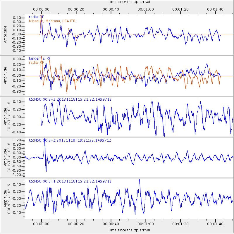
MSO Missoula, Montana, USA - Earthquake Result Viewer
*The percent match for this event was below the threshold and hence no stack was calculated.
| Earthquake location: |
Near S. Coast Of Honshu, Japan |
| Earthquake latitude/longitude: |
34.3/137.0 |
| Earthquake time(UTC): |
2013/11/18 (322) 19:10:45 GMT |
| Earthquake Depth: |
328 km |
| Earthquake Magnitude: |
5.6 MWW, 5.7 MWB, 5.7 MWC |
| Earthquake Catalog/Contributor: |
NEIC PDE/NEIC COMCAT |
|
| Network: |
US United States National Seismic Network |
| Station: |
MSO Missoula, Montana, USA |
| Lat/Lon: |
46.83 N/113.94 W |
| Elevation: |
1264 m |
|
| Distance: |
77.1 deg |
| Az: |
41.755 deg |
| Baz: |
306.621 deg |
| Ray Param: |
$rayparam |
*The percent match for this event was below the threshold and hence was not used in the summary stack. |
|
| Radial Match: |
62.813705 % |
| Radial Bump: |
400 |
| Transverse Match: |
42.425613 % |
| Transverse Bump: |
400 |
| SOD ConfigId: |
626651 |
| Insert Time: |
2014-04-19 17:32:22.214 +0000 |
| GWidth: |
2.5 |
| Max Bumps: |
400 |
| Tol: |
0.001 |
|
Signal To Noise
| Channel | StoN | STA | LTA |
| US:MSO:00:BHZ:20131118T19:21:32.149971Z | 4.573143 | 4.68583E-7 | 1.0246411E-7 |
| US:MSO:00:BH1:20131118T19:21:32.149971Z | 1.2125547 | 1.826234E-7 | 1.5061045E-7 |
| US:MSO:00:BH2:20131118T19:21:32.149971Z | 1.4488854 | 2.364157E-7 | 1.6317074E-7 |
| Arrivals |
| Ps | |
| PpPs | |
| PsPs/PpSs | |


