You are here: Home > Network List > BK - Berkeley Digital Seismograph Network Stations List
> Station CMB Columbia College, Columbia, CA > Earthquake Result Viewer
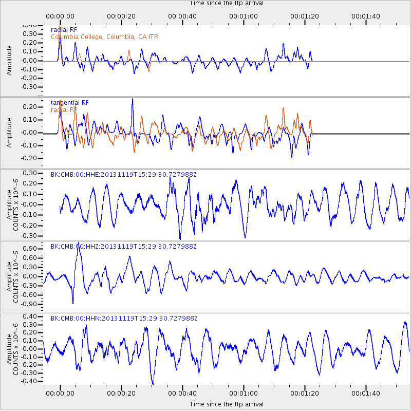
CMB Columbia College, Columbia, CA - Earthquake Result Viewer
*The percent match for this event was below the threshold and hence no stack was calculated.
| Earthquake location: |
W. Caroline Islands, Micronesia |
| Earthquake latitude/longitude: |
8.9/138.5 |
| Earthquake time(UTC): |
2013/11/19 (323) 15:16:48 GMT |
| Earthquake Depth: |
10 km |
| Earthquake Magnitude: |
5.9 MWW, 5.8 MWB, 6.0 MWC |
| Earthquake Catalog/Contributor: |
NEIC PDE/NEIC COMCAT |
|
| Network: |
BK Berkeley Digital Seismograph Network |
| Station: |
CMB Columbia College, Columbia, CA |
| Lat/Lon: |
38.03 N/120.39 W |
| Elevation: |
697 m |
|
| Distance: |
93.2 deg |
| Az: |
50.906 deg |
| Baz: |
283.795 deg |
| Ray Param: |
$rayparam |
*The percent match for this event was below the threshold and hence was not used in the summary stack. |
|
| Radial Match: |
69.0783 % |
| Radial Bump: |
400 |
| Transverse Match: |
63.23262 % |
| Transverse Bump: |
366 |
| SOD ConfigId: |
626651 |
| Insert Time: |
2014-04-19 17:52:18.236 +0000 |
| GWidth: |
2.5 |
| Max Bumps: |
400 |
| Tol: |
0.001 |
|
Signal To Noise
| Channel | StoN | STA | LTA |
| BK:CMB:00:HHZ:20131119T15:29:30.727988Z | 2.2706475 | 2.6552954E-7 | 1.16940015E-7 |
| BK:CMB:00:HHN:20131119T15:29:30.727988Z | 0.8664532 | 7.578833E-8 | 8.746962E-8 |
| BK:CMB:00:HHE:20131119T15:29:30.727988Z | 0.70169556 | 6.835133E-8 | 9.740881E-8 |
| Arrivals |
| Ps | |
| PpPs | |
| PsPs/PpSs | |


