You are here: Home > Network List > CN - Canadian National Seismograph Network Stations List
> Station INK INUVIK, NT > Earthquake Result Viewer
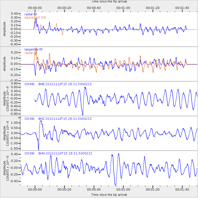
INK INUVIK, NT - Earthquake Result Viewer
*The percent match for this event was below the threshold and hence no stack was calculated.
| Earthquake location: |
W. Caroline Islands, Micronesia |
| Earthquake latitude/longitude: |
8.9/138.5 |
| Earthquake time(UTC): |
2013/11/19 (323) 15:16:48 GMT |
| Earthquake Depth: |
10 km |
| Earthquake Magnitude: |
5.9 MWW, 5.8 MWB, 6.0 MWC |
| Earthquake Catalog/Contributor: |
NEIC PDE/NEIC COMCAT |
|
| Network: |
CN Canadian National Seismograph Network |
| Station: |
INK INUVIK, NT |
| Lat/Lon: |
68.31 N/133.53 W |
| Elevation: |
44 m |
|
| Distance: |
81.0 deg |
| Az: |
22.096 deg |
| Baz: |
271.409 deg |
| Ray Param: |
$rayparam |
*The percent match for this event was below the threshold and hence was not used in the summary stack. |
|
| Radial Match: |
60.534363 % |
| Radial Bump: |
400 |
| Transverse Match: |
55.982685 % |
| Transverse Bump: |
400 |
| SOD ConfigId: |
626651 |
| Insert Time: |
2014-04-19 17:54:21.393 +0000 |
| GWidth: |
2.5 |
| Max Bumps: |
400 |
| Tol: |
0.001 |
|
Signal To Noise
| Channel | StoN | STA | LTA |
| CN:INK: :BHZ:20131119T15:28:31.500022Z | 3.0411847 | 7.7867924E-7 | 2.560447E-7 |
| CN:INK: :BHN:20131119T15:28:31.500022Z | 0.9086176 | 1.1045776E-7 | 1.2156683E-7 |
| CN:INK: :BHE:20131119T15:28:31.500022Z | 2.1373253 | 4.6465436E-7 | 2.1739994E-7 |
| Arrivals |
| Ps | |
| PpPs | |
| PsPs/PpSs | |


