NIL Nilore, Pakistan - Earthquake Result Viewer
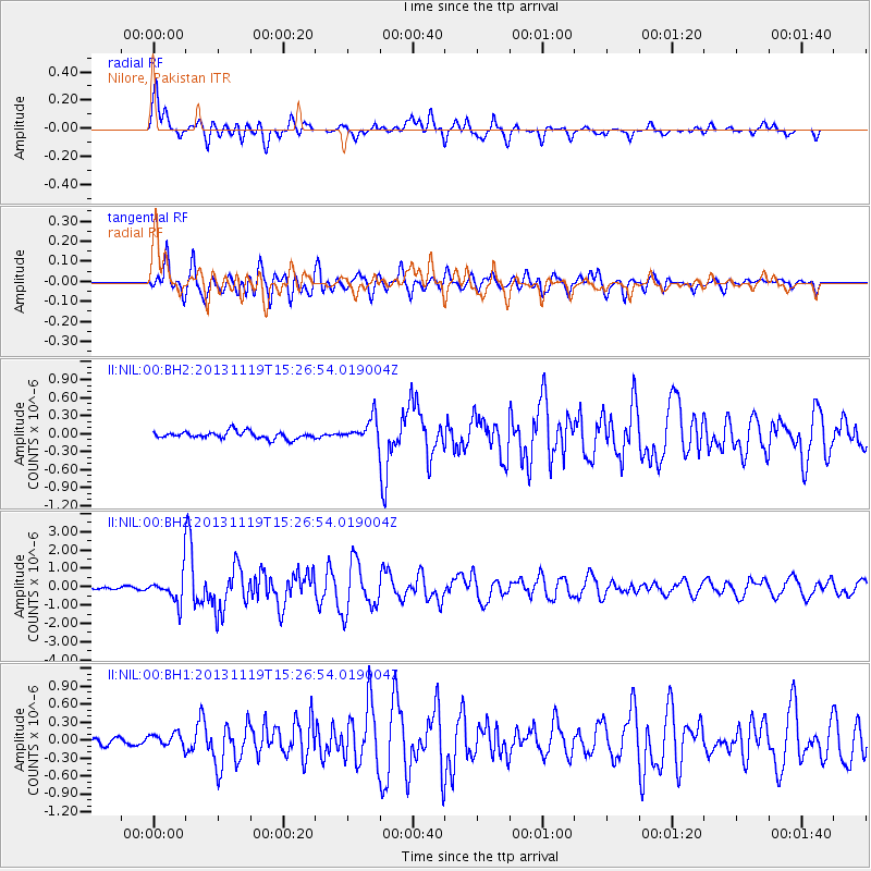
Earthquake location: W. Caroline Islands, Micronesia
Earthquake latitude/longitude: 8.9/138.5
Earthquake time(UTC): 2013/11/19 (323) 15:16:48 GMT
Earthquake Depth: 10 km
Earthquake Magnitude: 5.9 MWW, 5.8 MWB, 6.0 MWC
Earthquake Catalog/Contributor: NEIC PDE/NEIC COMCAT
Network: II Global Seismograph Network (GSN - IRIS/IDA)
Station: NIL Nilore, Pakistan
Lat/Lon: 33.65 N/73.27 E
Elevation: 629 m
Distance: 64.5 deg
Az: 302.96 deg
Baz: 96.334 deg
Ray Param: 0.058852524
Estimated Moho Depth: 17.0 km
Estimated Crust Vp/Vs: 1.61
Assumed Crust Vp: 6.242 km/s
Estimated Crust Vs: 3.889 km/s
Estimated Crust Poisson's Ratio: 0.18
Radial Match: 90.65217 %
Radial Bump: 400
Transverse Match: 88.14101 %
Transverse Bump: 400
SOD ConfigId: 626651
Insert Time: 2014-04-19 17:56:30.875 +0000
GWidth: 2.5
Max Bumps: 400
Tol: 0.001

Signal To Noise

ChannelStoNSTALTA
II:NIL:00:BHZ:20131119T15:26:54.019004Z11.0683248.1042E-77.321976E-8
II:NIL:00:BH1:20131119T15:26:54.019004Z1.18201821.1222532E-79.4943815E-8
II:NIL:00:BH2:20131119T15:26:54.019004Z3.25759481.948516E-75.981456E-8
Arrivals
Ps1.7 SECOND
PpPs6.8 SECOND
PsPs/PpSs8.5 SECOND