You are here: Home > Network List > II - Global Seismograph Network (GSN - IRIS/IDA) Stations List
> Station WRAB Tennant Creek, NT, Australia > Earthquake Result Viewer
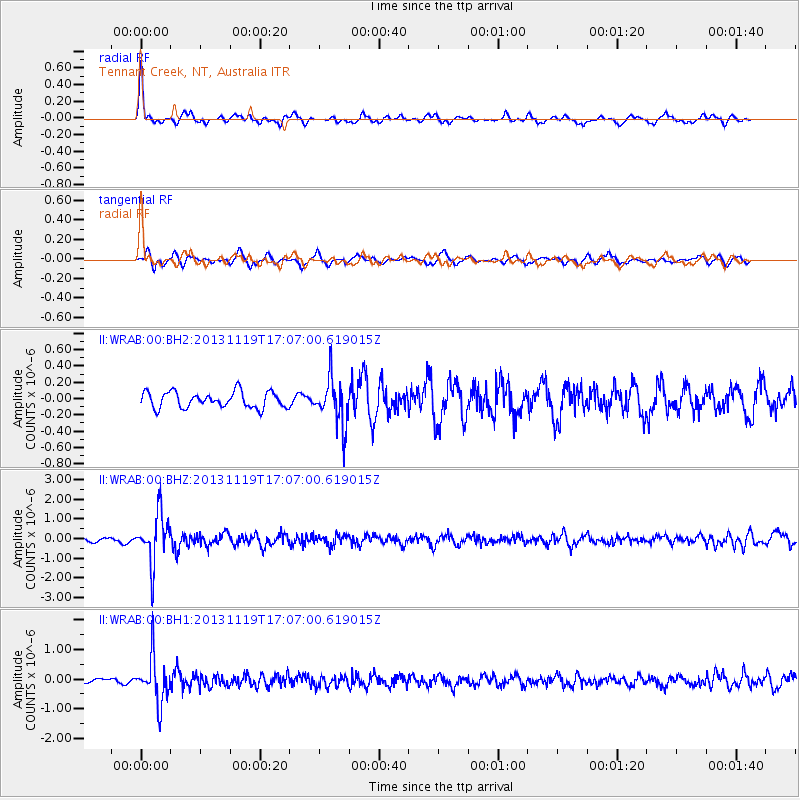
WRAB Tennant Creek, NT, Australia - Earthquake Result Viewer
*The percent match for this event was below the threshold and hence no stack was calculated.
| Earthquake location: |
Mariana Islands |
| Earthquake latitude/longitude: |
18.5/145.2 |
| Earthquake time(UTC): |
2013/11/19 (323) 17:00:44 GMT |
| Earthquake Depth: |
511 km |
| Earthquake Magnitude: |
6.0 MWW, 6.0 MWC, 6.0 MWB |
| Earthquake Catalog/Contributor: |
NEIC PDE/NEIC COMCAT |
|
| Network: |
II Global Seismograph Network (GSN - IRIS/IDA) |
| Station: |
WRAB Tennant Creek, NT, Australia |
| Lat/Lon: |
19.93 S/134.36 E |
| Elevation: |
366 m |
|
| Distance: |
39.6 deg |
| Az: |
196.113 deg |
| Baz: |
16.259 deg |
| Ray Param: |
$rayparam |
*The percent match for this event was below the threshold and hence was not used in the summary stack. |
|
| Radial Match: |
75.46283 % |
| Radial Bump: |
302 |
| Transverse Match: |
67.161385 % |
| Transverse Bump: |
341 |
| SOD ConfigId: |
626651 |
| Insert Time: |
2014-04-19 18:14:40.008 +0000 |
| GWidth: |
2.5 |
| Max Bumps: |
400 |
| Tol: |
0.001 |
|
Signal To Noise
| Channel | StoN | STA | LTA |
| II:WRAB:00:BHZ:20131119T17:07:00.619015Z | 8.467885 | 1.2382184E-6 | 1.4622522E-7 |
| II:WRAB:00:BH1:20131119T17:07:00.619015Z | 9.514122 | 7.522315E-7 | 7.906473E-8 |
| II:WRAB:00:BH2:20131119T17:07:00.619015Z | 2.9781601 | 2.9150237E-7 | 9.788002E-8 |
| Arrivals |
| Ps | |
| PpPs | |
| PsPs/PpSs | |


