You are here: Home > Network List > IU - Global Seismograph Network (GSN - IRIS/USGS) Stations List
> Station CTAO Charters Towers, Australia > Earthquake Result Viewer
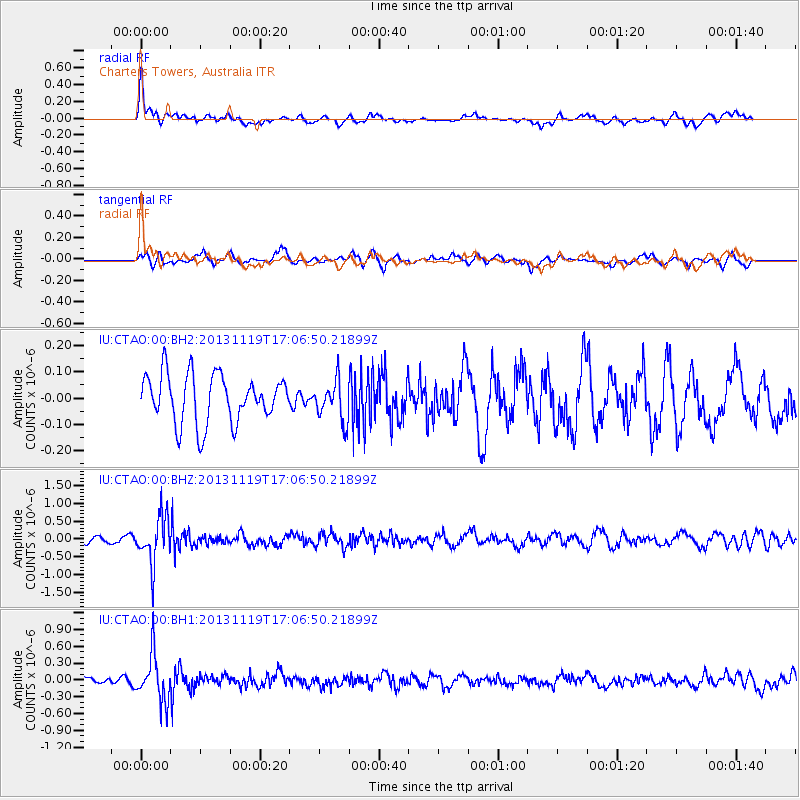
CTAO Charters Towers, Australia - Earthquake Result Viewer
*The percent match for this event was below the threshold and hence no stack was calculated.
| Earthquake location: |
Mariana Islands |
| Earthquake latitude/longitude: |
18.5/145.2 |
| Earthquake time(UTC): |
2013/11/19 (323) 17:00:44 GMT |
| Earthquake Depth: |
511 km |
| Earthquake Magnitude: |
6.0 MWW, 6.0 MWC, 6.0 MWB |
| Earthquake Catalog/Contributor: |
NEIC PDE/NEIC COMCAT |
|
| Network: |
IU Global Seismograph Network (GSN - IRIS/USGS) |
| Station: |
CTAO Charters Towers, Australia |
| Lat/Lon: |
20.09 S/146.25 E |
| Elevation: |
357 m |
|
| Distance: |
38.3 deg |
| Az: |
178.408 deg |
| Baz: |
358.393 deg |
| Ray Param: |
$rayparam |
*The percent match for this event was below the threshold and hence was not used in the summary stack. |
|
| Radial Match: |
71.77096 % |
| Radial Bump: |
400 |
| Transverse Match: |
54.90495 % |
| Transverse Bump: |
400 |
| SOD ConfigId: |
626651 |
| Insert Time: |
2014-04-19 18:15:07.671 +0000 |
| GWidth: |
2.5 |
| Max Bumps: |
400 |
| Tol: |
0.001 |
|
Signal To Noise
| Channel | StoN | STA | LTA |
| IU:CTAO:00:BHZ:20131119T17:06:50.21899Z | 7.382135 | 6.665274E-7 | 9.028924E-8 |
| IU:CTAO:00:BH1:20131119T17:06:50.21899Z | 8.140024 | 4.2119524E-7 | 5.1743733E-8 |
| IU:CTAO:00:BH2:20131119T17:06:50.21899Z | 0.8512366 | 7.7276795E-8 | 9.07818E-8 |
| Arrivals |
| Ps | |
| PpPs | |
| PsPs/PpSs | |


