You are here: Home > Network List > IW - Intermountain West Stations List
> Station DLMT Dillon, Montana, USA > Earthquake Result Viewer
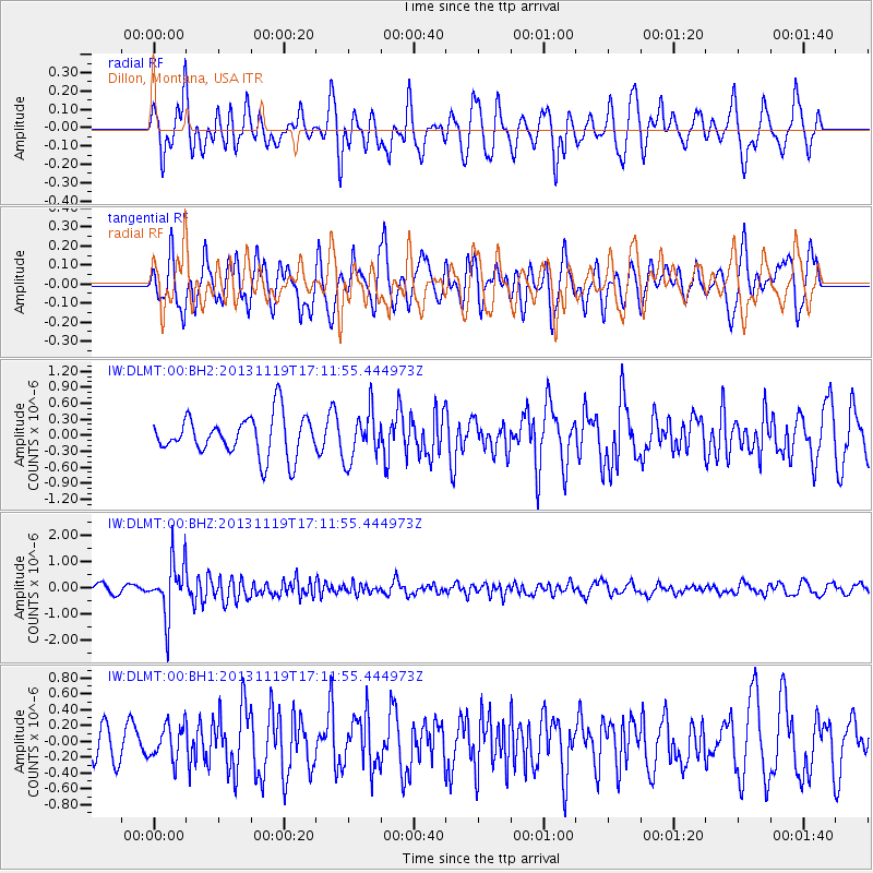
DLMT Dillon, Montana, USA - Earthquake Result Viewer
*The percent match for this event was below the threshold and hence no stack was calculated.
| Earthquake location: |
Mariana Islands |
| Earthquake latitude/longitude: |
18.5/145.2 |
| Earthquake time(UTC): |
2013/11/19 (323) 17:00:44 GMT |
| Earthquake Depth: |
511 km |
| Earthquake Magnitude: |
6.0 MWW, 6.0 MWC, 6.0 MWB |
| Earthquake Catalog/Contributor: |
NEIC PDE/NEIC COMCAT |
|
| Network: |
IW Intermountain West |
| Station: |
DLMT Dillon, Montana, USA |
| Lat/Lon: |
45.36 N/112.60 W |
| Elevation: |
1569 m |
|
| Distance: |
85.3 deg |
| Az: |
43.742 deg |
| Baz: |
291.44 deg |
| Ray Param: |
$rayparam |
*The percent match for this event was below the threshold and hence was not used in the summary stack. |
|
| Radial Match: |
60.227764 % |
| Radial Bump: |
400 |
| Transverse Match: |
66.86923 % |
| Transverse Bump: |
400 |
| SOD ConfigId: |
626651 |
| Insert Time: |
2014-04-19 18:15:51.964 +0000 |
| GWidth: |
2.5 |
| Max Bumps: |
400 |
| Tol: |
0.001 |
|
Signal To Noise
| Channel | StoN | STA | LTA |
| IW:DLMT:00:BHZ:20131119T17:11:55.444973Z | 7.313187 | 1.0434998E-6 | 1.4268741E-7 |
| IW:DLMT:00:BH1:20131119T17:11:55.444973Z | 0.886406 | 2.1620714E-7 | 2.4391434E-7 |
| IW:DLMT:00:BH2:20131119T17:11:55.444973Z | 1.2335083 | 4.5853483E-7 | 3.7173223E-7 |
| Arrivals |
| Ps | |
| PpPs | |
| PsPs/PpSs | |


