You are here: Home > Network List > UW - Pacific Northwest Regional Seismic Network Stations List
> Station PASS Maple Falls, WA, USA > Earthquake Result Viewer
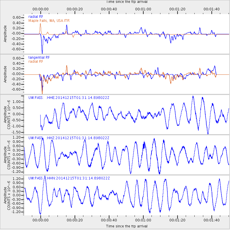
PASS Maple Falls, WA, USA - Earthquake Result Viewer
*The percent match for this event was below the threshold and hence no stack was calculated.
| Earthquake location: |
New Britain Region, P.N.G. |
| Earthquake latitude/longitude: |
-5.6/150.6 |
| Earthquake time(UTC): |
2014/12/15 (349) 01:18:48 GMT |
| Earthquake Depth: |
118 km |
| Earthquake Magnitude: |
4.9 MW, 5.1 mb |
| Earthquake Catalog/Contributor: |
ISC/ISC |
|
| Network: |
UW Pacific Northwest Regional Seismic Network |
| Station: |
PASS Maple Falls, WA, USA |
| Lat/Lon: |
49.00 N/122.09 W |
| Elevation: |
174 m |
|
| Distance: |
92.4 deg |
| Az: |
41.182 deg |
| Baz: |
264.305 deg |
| Ray Param: |
$rayparam |
*The percent match for this event was below the threshold and hence was not used in the summary stack. |
|
| Radial Match: |
67.83665 % |
| Radial Bump: |
400 |
| Transverse Match: |
71.387215 % |
| Transverse Bump: |
400 |
| SOD ConfigId: |
3390531 |
| Insert Time: |
2019-04-15 13:42:26.276 +0000 |
| GWidth: |
2.5 |
| Max Bumps: |
400 |
| Tol: |
0.001 |
|
Signal To Noise
| Channel | StoN | STA | LTA |
| UW:PASS: :HHZ:20141215T01:31:14.898022Z | 1.3936764 | 8.05765E-7 | 5.781579E-7 |
| UW:PASS: :HHN:20141215T01:31:14.898022Z | 3.4871123 | 9.0704054E-7 | 2.6011222E-7 |
| UW:PASS: :HHE:20141215T01:31:14.898022Z | 1.1553097 | 6.2442984E-7 | 5.4048695E-7 |
| Arrivals |
| Ps | |
| PpPs | |
| PsPs/PpSs | |


