You are here: Home > Network List > TA - USArray Transportable Network (new EarthScope stations) Stations List
> Station MDND Maddock, ND, USA > Earthquake Result Viewer
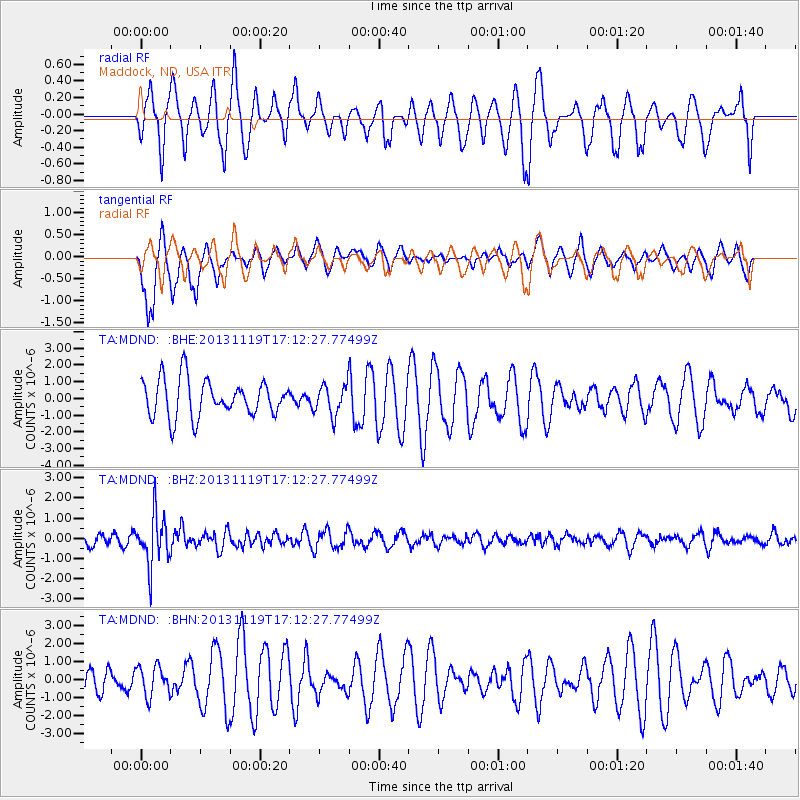
MDND Maddock, ND, USA - Earthquake Result Viewer
*The percent match for this event was below the threshold and hence no stack was calculated.
| Earthquake location: |
Mariana Islands |
| Earthquake latitude/longitude: |
18.5/145.2 |
| Earthquake time(UTC): |
2013/11/19 (323) 17:00:44 GMT |
| Earthquake Depth: |
511 km |
| Earthquake Magnitude: |
6.0 MWW, 6.0 MWC, 6.0 MWB |
| Earthquake Catalog/Contributor: |
NEIC PDE/NEIC COMCAT |
|
| Network: |
TA USArray Transportable Network (new EarthScope stations) |
| Station: |
MDND Maddock, ND, USA |
| Lat/Lon: |
47.85 N/99.60 W |
| Elevation: |
479 m |
|
| Distance: |
92.3 deg |
| Az: |
37.588 deg |
| Baz: |
300.742 deg |
| Ray Param: |
$rayparam |
*The percent match for this event was below the threshold and hence was not used in the summary stack. |
|
| Radial Match: |
44.147217 % |
| Radial Bump: |
319 |
| Transverse Match: |
75.86514 % |
| Transverse Bump: |
325 |
| SOD ConfigId: |
626651 |
| Insert Time: |
2014-04-19 18:21:38.382 +0000 |
| GWidth: |
2.5 |
| Max Bumps: |
400 |
| Tol: |
0.001 |
|
Signal To Noise
| Channel | StoN | STA | LTA |
| TA:MDND: :BHZ:20131119T17:12:27.77499Z | 3.5376098 | 1.2678803E-6 | 3.5840029E-7 |
| TA:MDND: :BHN:20131119T17:12:27.77499Z | 0.49003512 | 8.3026714E-7 | 1.6943013E-6 |
| TA:MDND: :BHE:20131119T17:12:27.77499Z | 0.8013905 | 8.884102E-7 | 1.1085858E-6 |
| Arrivals |
| Ps | |
| PpPs | |
| PsPs/PpSs | |


