You are here: Home > Network List > TA - USArray Transportable Network (new EarthScope stations) Stations List
> Station T25A Trinidad, CO, USA > Earthquake Result Viewer
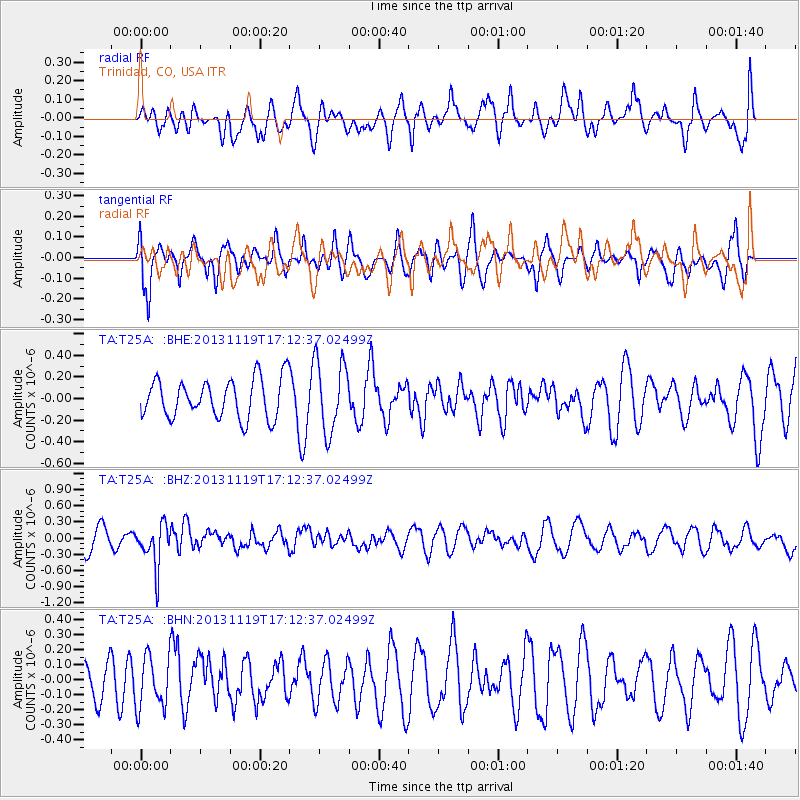
T25A Trinidad, CO, USA - Earthquake Result Viewer
*The percent match for this event was below the threshold and hence no stack was calculated.
| Earthquake location: |
Mariana Islands |
| Earthquake latitude/longitude: |
18.5/145.2 |
| Earthquake time(UTC): |
2013/11/19 (323) 17:00:44 GMT |
| Earthquake Depth: |
511 km |
| Earthquake Magnitude: |
6.0 MWW, 6.0 MWC, 6.0 MWB |
| Earthquake Catalog/Contributor: |
NEIC PDE/NEIC COMCAT |
|
| Network: |
TA USArray Transportable Network (new EarthScope stations) |
| Station: |
T25A Trinidad, CO, USA |
| Lat/Lon: |
37.14 N/104.41 W |
| Elevation: |
2017 m |
|
| Distance: |
94.3 deg |
| Az: |
48.693 deg |
| Baz: |
296.854 deg |
| Ray Param: |
$rayparam |
*The percent match for this event was below the threshold and hence was not used in the summary stack. |
|
| Radial Match: |
52.592045 % |
| Radial Bump: |
400 |
| Transverse Match: |
71.098335 % |
| Transverse Bump: |
400 |
| SOD ConfigId: |
626651 |
| Insert Time: |
2014-04-19 18:22:00.277 +0000 |
| GWidth: |
2.5 |
| Max Bumps: |
400 |
| Tol: |
0.001 |
|
Signal To Noise
| Channel | StoN | STA | LTA |
| TA:T25A: :BHZ:20131119T17:12:37.02499Z | 2.1976829 | 4.0151463E-7 | 1.8269907E-7 |
| TA:T25A: :BHN:20131119T17:12:37.02499Z | 1.4149642 | 1.7289494E-7 | 1.2219033E-7 |
| TA:T25A: :BHE:20131119T17:12:37.02499Z | 1.840288 | 3.3206263E-7 | 1.8044057E-7 |
| Arrivals |
| Ps | |
| PpPs | |
| PsPs/PpSs | |


