You are here: Home > Network List > US - United States National Seismic Network Stations List
> Station BOZ Bozeman, Montana, USA > Earthquake Result Viewer
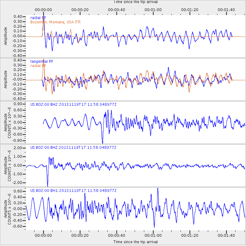
BOZ Bozeman, Montana, USA - Earthquake Result Viewer
*The percent match for this event was below the threshold and hence no stack was calculated.
| Earthquake location: |
Mariana Islands |
| Earthquake latitude/longitude: |
18.5/145.2 |
| Earthquake time(UTC): |
2013/11/19 (323) 17:00:44 GMT |
| Earthquake Depth: |
511 km |
| Earthquake Magnitude: |
6.0 MWW, 6.0 MWC, 6.0 MWB |
| Earthquake Catalog/Contributor: |
NEIC PDE/NEIC COMCAT |
|
| Network: |
US United States National Seismic Network |
| Station: |
BOZ Bozeman, Montana, USA |
| Lat/Lon: |
45.65 N/111.63 W |
| Elevation: |
1589 m |
|
| Distance: |
85.8 deg |
| Az: |
43.224 deg |
| Baz: |
292.088 deg |
| Ray Param: |
$rayparam |
*The percent match for this event was below the threshold and hence was not used in the summary stack. |
|
| Radial Match: |
63.292156 % |
| Radial Bump: |
400 |
| Transverse Match: |
57.868027 % |
| Transverse Bump: |
400 |
| SOD ConfigId: |
626651 |
| Insert Time: |
2014-04-19 18:22:34.386 +0000 |
| GWidth: |
2.5 |
| Max Bumps: |
400 |
| Tol: |
0.001 |
|
Signal To Noise
| Channel | StoN | STA | LTA |
| US:BOZ:00:BHZ:20131119T17:11:58.048977Z | 7.046458 | 7.6875534E-7 | 1.0909813E-7 |
| US:BOZ:00:BH1:20131119T17:11:58.048977Z | 1.3063875 | 2.7156105E-7 | 2.0787174E-7 |
| US:BOZ:00:BH2:20131119T17:11:58.048977Z | 2.3374908 | 3.7328408E-7 | 1.5969435E-7 |
| Arrivals |
| Ps | |
| PpPs | |
| PsPs/PpSs | |


