You are here: Home > Network List > US - United States National Seismic Network Stations List
> Station EGMT Eagleton, Montana, USA > Earthquake Result Viewer
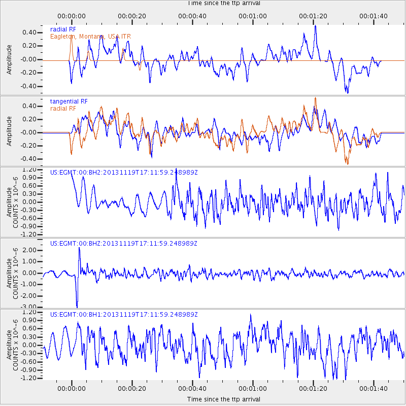
EGMT Eagleton, Montana, USA - Earthquake Result Viewer
*The percent match for this event was below the threshold and hence no stack was calculated.
| Earthquake location: |
Mariana Islands |
| Earthquake latitude/longitude: |
18.5/145.2 |
| Earthquake time(UTC): |
2013/11/19 (323) 17:00:44 GMT |
| Earthquake Depth: |
511 km |
| Earthquake Magnitude: |
6.0 MWW, 6.0 MWC, 6.0 MWB |
| Earthquake Catalog/Contributor: |
NEIC PDE/NEIC COMCAT |
|
| Network: |
US United States National Seismic Network |
| Station: |
EGMT Eagleton, Montana, USA |
| Lat/Lon: |
48.02 N/109.75 W |
| Elevation: |
1055 m |
|
| Distance: |
86.1 deg |
| Az: |
40.527 deg |
| Baz: |
293.261 deg |
| Ray Param: |
$rayparam |
*The percent match for this event was below the threshold and hence was not used in the summary stack. |
|
| Radial Match: |
53.4173 % |
| Radial Bump: |
400 |
| Transverse Match: |
47.67709 % |
| Transverse Bump: |
400 |
| SOD ConfigId: |
626651 |
| Insert Time: |
2014-04-19 18:22:48.256 +0000 |
| GWidth: |
2.5 |
| Max Bumps: |
400 |
| Tol: |
0.001 |
|
Signal To Noise
| Channel | StoN | STA | LTA |
| US:EGMT:00:BHZ:20131119T17:11:59.248989Z | 7.2247095 | 1.04762E-6 | 1.4500515E-7 |
| US:EGMT:00:BH1:20131119T17:11:59.248989Z | 1.5969613 | 4.651645E-7 | 2.9128103E-7 |
| US:EGMT:00:BH2:20131119T17:11:59.248989Z | 1.2355553 | 4.3196593E-7 | 3.4961275E-7 |
| Arrivals |
| Ps | |
| PpPs | |
| PsPs/PpSs | |


