You are here: Home > Network List > US - United States National Seismic Network Stations List
> Station MSO Missoula, Montana, USA > Earthquake Result Viewer
MSO Missoula, Montana, USA - Earthquake Result Viewer
*The percent match for this event was below the threshold and hence no stack was calculated.
| Earthquake location: |
Mariana Islands |
| Earthquake latitude/longitude: |
18.5/145.2 |
| Earthquake time(UTC): |
2013/11/19 (323) 17:00:44 GMT |
| Earthquake Depth: |
511 km |
| Earthquake Magnitude: |
6.0 MWW, 6.0 MWC, 6.0 MWB |
| Earthquake Catalog/Contributor: |
NEIC PDE/NEIC COMCAT |
|
| Network: |
US United States National Seismic Network |
| Station: |
MSO Missoula, Montana, USA |
| Lat/Lon: |
46.83 N/113.94 W |
| Elevation: |
1264 m |
|
| Distance: |
83.9 deg |
| Az: |
42.701 deg |
| Baz: |
290.377 deg |
| Ray Param: |
$rayparam |
*The percent match for this event was below the threshold and hence was not used in the summary stack. |
|
| Radial Match: |
46.465656 % |
| Radial Bump: |
400 |
| Transverse Match: |
40.36274 % |
| Transverse Bump: |
400 |
| SOD ConfigId: |
626651 |
| Insert Time: |
2014-04-19 18:23:04.910 +0000 |
| GWidth: |
2.5 |
| Max Bumps: |
400 |
| Tol: |
0.001 |
|
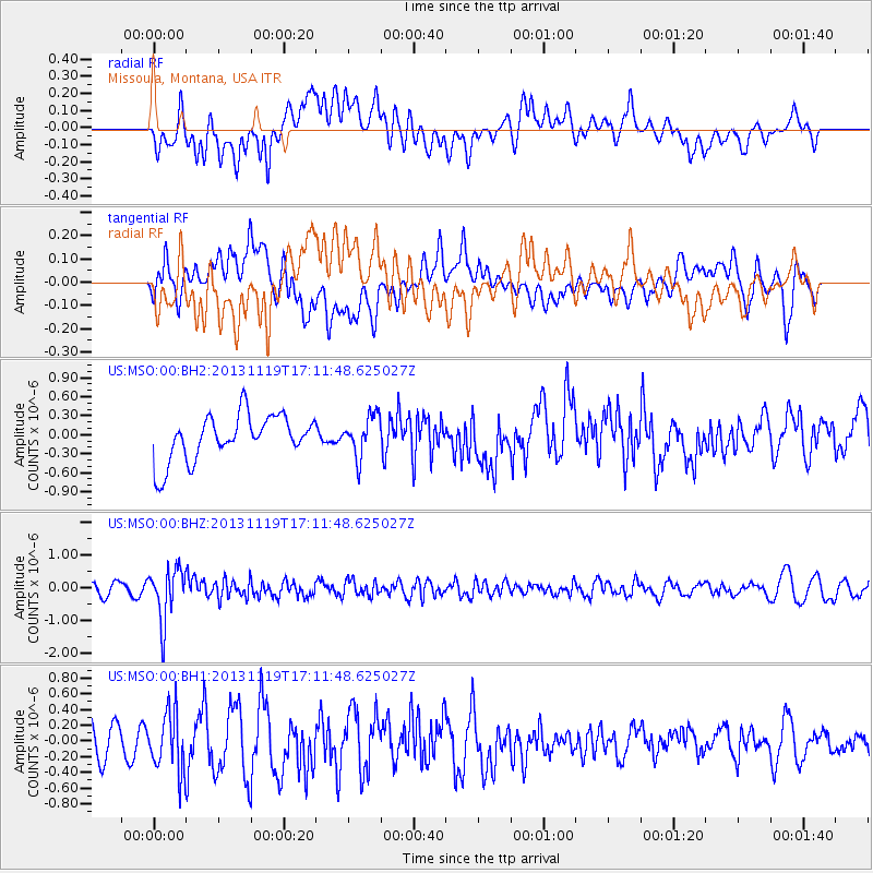
Signal To Noise
| Channel | StoN | STA | LTA |
| US:MSO:00:BHZ:20131119T17:11:48.625027Z | 4.1757026 | 7.9812605E-7 | 1.9113574E-7 |
| US:MSO:00:BH1:20131119T17:11:48.625027Z | 1.6077788 | 3.8081512E-7 | 2.3685791E-7 |
| US:MSO:00:BH2:20131119T17:11:48.625027Z | 0.8967597 | 3.2102554E-7 | 3.5798394E-7 |
| Arrivals |
| Ps | |
| PpPs | |
| PsPs/PpSs | |


