You are here: Home > Network List > US - United States National Seismic Network Stations List
> Station NEW Newport, Washington, USA > Earthquake Result Viewer
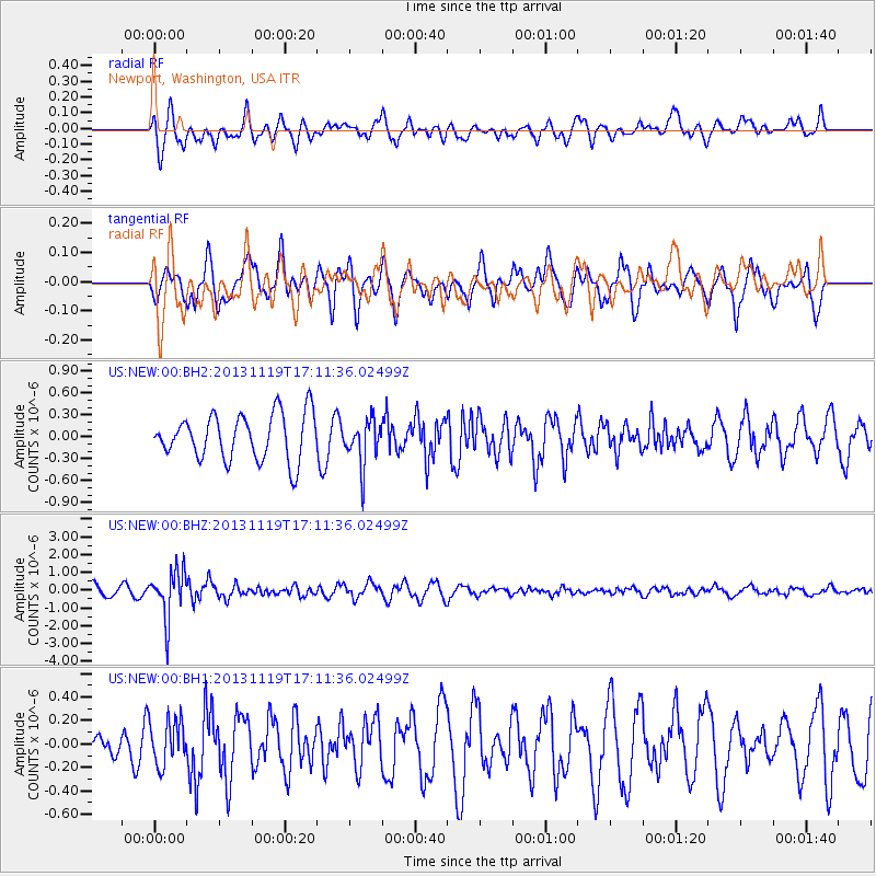
NEW Newport, Washington, USA - Earthquake Result Viewer
*The percent match for this event was below the threshold and hence no stack was calculated.
| Earthquake location: |
Mariana Islands |
| Earthquake latitude/longitude: |
18.5/145.2 |
| Earthquake time(UTC): |
2013/11/19 (323) 17:00:44 GMT |
| Earthquake Depth: |
511 km |
| Earthquake Magnitude: |
6.0 MWW, 6.0 MWC, 6.0 MWB |
| Earthquake Catalog/Contributor: |
NEIC PDE/NEIC COMCAT |
|
| Network: |
US United States National Seismic Network |
| Station: |
NEW Newport, Washington, USA |
| Lat/Lon: |
48.26 N/117.12 W |
| Elevation: |
760 m |
|
| Distance: |
81.4 deg |
| Az: |
42.048 deg |
| Baz: |
287.954 deg |
| Ray Param: |
$rayparam |
*The percent match for this event was below the threshold and hence was not used in the summary stack. |
|
| Radial Match: |
55.559776 % |
| Radial Bump: |
400 |
| Transverse Match: |
45.217308 % |
| Transverse Bump: |
400 |
| SOD ConfigId: |
626651 |
| Insert Time: |
2014-04-19 18:23:08.780 +0000 |
| GWidth: |
2.5 |
| Max Bumps: |
400 |
| Tol: |
0.001 |
|
Signal To Noise
| Channel | StoN | STA | LTA |
| US:NEW:00:BHZ:20131119T17:11:36.02499Z | 4.961246 | 1.3530647E-6 | 2.727268E-7 |
| US:NEW:00:BH1:20131119T17:11:36.02499Z | 1.4588556 | 1.8968632E-7 | 1.3002406E-7 |
| US:NEW:00:BH2:20131119T17:11:36.02499Z | 0.98652893 | 3.084672E-7 | 3.1267933E-7 |
| Arrivals |
| Ps | |
| PpPs | |
| PsPs/PpSs | |


