You are here: Home > Network List > TA - USArray Transportable Network (new EarthScope stations) Stations List
> Station X60A Albert Glenn Thornton, NC, USA > Earthquake Result Viewer
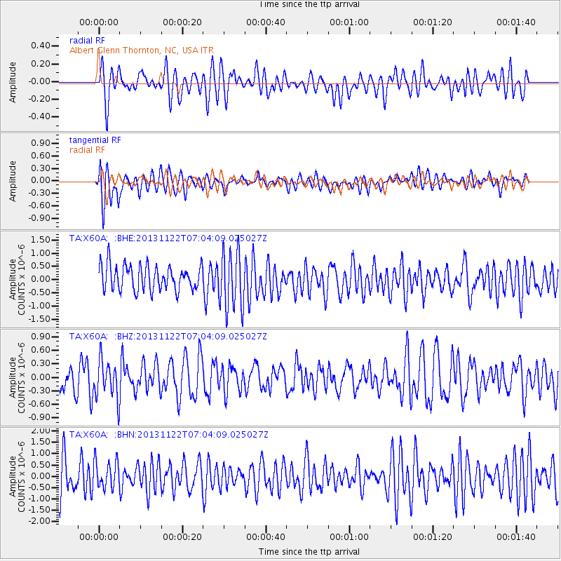
X60A Albert Glenn Thornton, NC, USA - Earthquake Result Viewer
*The percent match for this event was below the threshold and hence no stack was calculated.
| Earthquake location: |
Iran-Iraq Border Region |
| Earthquake latitude/longitude: |
34.5/45.5 |
| Earthquake time(UTC): |
2013/11/22 (326) 06:51:25 GMT |
| Earthquake Depth: |
6.0 km |
| Earthquake Magnitude: |
5.6 MWB, 5.7 MWC |
| Earthquake Catalog/Contributor: |
NEIC PDE/NEIC COMCAT |
|
| Network: |
TA USArray Transportable Network (new EarthScope stations) |
| Station: |
X60A Albert Glenn Thornton, NC, USA |
| Lat/Lon: |
34.58 N/77.98 W |
| Elevation: |
12 m |
|
| Distance: |
93.3 deg |
| Az: |
316.406 deg |
| Baz: |
43.672 deg |
| Ray Param: |
$rayparam |
*The percent match for this event was below the threshold and hence was not used in the summary stack. |
|
| Radial Match: |
46.17272 % |
| Radial Bump: |
400 |
| Transverse Match: |
68.79589 % |
| Transverse Bump: |
400 |
| SOD ConfigId: |
626651 |
| Insert Time: |
2014-04-19 18:58:03.224 +0000 |
| GWidth: |
2.5 |
| Max Bumps: |
400 |
| Tol: |
0.001 |
|
Signal To Noise
| Channel | StoN | STA | LTA |
| TA:X60A: :BHZ:20131122T07:04:09.025027Z | 1.3469962 | 4.2810916E-7 | 3.1782508E-7 |
| TA:X60A: :BHN:20131122T07:04:09.025027Z | 0.77817124 | 6.184229E-7 | 7.947132E-7 |
| TA:X60A: :BHE:20131122T07:04:09.025027Z | 2.381525 | 1.1147536E-6 | 4.680839E-7 |
| Arrivals |
| Ps | |
| PpPs | |
| PsPs/PpSs | |


