You are here: Home > Network List > WI - West Indies IPGP Network Stations List
> Station MAGL Barre de l'ile, Saint louis, Marie Galante > Earthquake Result Viewer
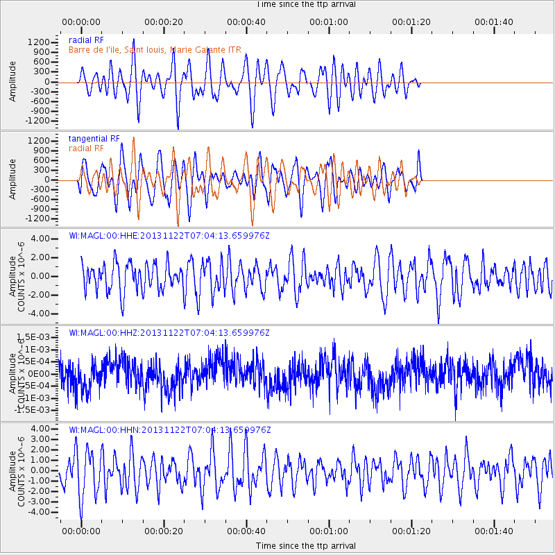
MAGL Barre de l'ile, Saint louis, Marie Galante - Earthquake Result Viewer
*The percent match for this event was below the threshold and hence no stack was calculated.
| Earthquake location: |
Iran-Iraq Border Region |
| Earthquake latitude/longitude: |
34.5/45.5 |
| Earthquake time(UTC): |
2013/11/22 (326) 06:51:25 GMT |
| Earthquake Depth: |
6.0 km |
| Earthquake Magnitude: |
5.6 MWB, 5.7 MWC |
| Earthquake Catalog/Contributor: |
NEIC PDE/NEIC COMCAT |
|
| Network: |
WI West Indies IPGP Network |
| Station: |
MAGL Barre de l'ile, Saint louis, Marie Galante |
| Lat/Lon: |
15.95 N/61.28 W |
| Elevation: |
150 m |
|
| Distance: |
94.3 deg |
| Az: |
292.521 deg |
| Baz: |
52.51 deg |
| Ray Param: |
$rayparam |
*The percent match for this event was below the threshold and hence was not used in the summary stack. |
|
| Radial Match: |
38.91924 % |
| Radial Bump: |
400 |
| Transverse Match: |
38.025146 % |
| Transverse Bump: |
400 |
| SOD ConfigId: |
626651 |
| Insert Time: |
2014-04-19 19:00:19.378 +0000 |
| GWidth: |
2.5 |
| Max Bumps: |
400 |
| Tol: |
0.001 |
|
Signal To Noise
| Channel | StoN | STA | LTA |
| WI:MAGL:00:HHZ:20131122T07:04:13.659976Z | 1.1335387 | 5.6815763E-10 | 5.0122473E-10 |
| WI:MAGL:00:HHN:20131122T07:04:13.659976Z | 2.268733 | 2.2630143E-6 | 9.974793E-7 |
| WI:MAGL:00:HHE:20131122T07:04:13.659976Z | 1.1065679 | 1.5613305E-6 | 1.4109668E-6 |
| Arrivals |
| Ps | |
| PpPs | |
| PsPs/PpSs | |


