You are here: Home > Network List > IU - Global Seismograph Network (GSN - IRIS/USGS) Stations List
> Station CTAO Charters Towers, Australia > Earthquake Result Viewer
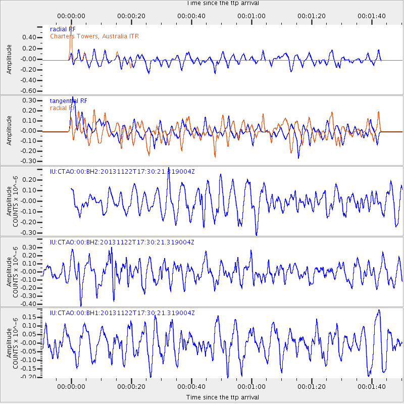
CTAO Charters Towers, Australia - Earthquake Result Viewer
*The percent match for this event was below the threshold and hence no stack was calculated.
| Earthquake location: |
Off W Coast Of Northern Sumatra |
| Earthquake latitude/longitude: |
5.4/92.8 |
| Earthquake time(UTC): |
2013/11/22 (326) 17:20:58 GMT |
| Earthquake Depth: |
16 km |
| Earthquake Magnitude: |
5.5 MWW, 5.3 MWB, 5.5 MWC |
| Earthquake Catalog/Contributor: |
NEIC PDE/NEIC COMCAT |
|
| Network: |
IU Global Seismograph Network (GSN - IRIS/USGS) |
| Station: |
CTAO Charters Towers, Australia |
| Lat/Lon: |
20.09 S/146.25 E |
| Elevation: |
357 m |
|
| Distance: |
58.3 deg |
| Az: |
117.47 deg |
| Baz: |
289.979 deg |
| Ray Param: |
$rayparam |
*The percent match for this event was below the threshold and hence was not used in the summary stack. |
|
| Radial Match: |
48.966843 % |
| Radial Bump: |
400 |
| Transverse Match: |
62.30348 % |
| Transverse Bump: |
400 |
| SOD ConfigId: |
626651 |
| Insert Time: |
2014-04-19 19:06:58.729 +0000 |
| GWidth: |
2.5 |
| Max Bumps: |
400 |
| Tol: |
0.001 |
|
Signal To Noise
| Channel | StoN | STA | LTA |
| IU:CTAO:00:BHZ:20131122T17:30:21.319004Z | 1.7996004 | 1.7901742E-7 | 9.94762E-8 |
| IU:CTAO:00:BH1:20131122T17:30:21.319004Z | 1.174847 | 7.65373E-8 | 6.514661E-8 |
| IU:CTAO:00:BH2:20131122T17:30:21.319004Z | 1.8867979 | 1.4388479E-7 | 7.6258715E-8 |
| Arrivals |
| Ps | |
| PpPs | |
| PsPs/PpSs | |


