You are here: Home > Network List > IC - New China Digital Seismograph Network Stations List
> Station KMI Kunming, Yunnan Province, China > Earthquake Result Viewer
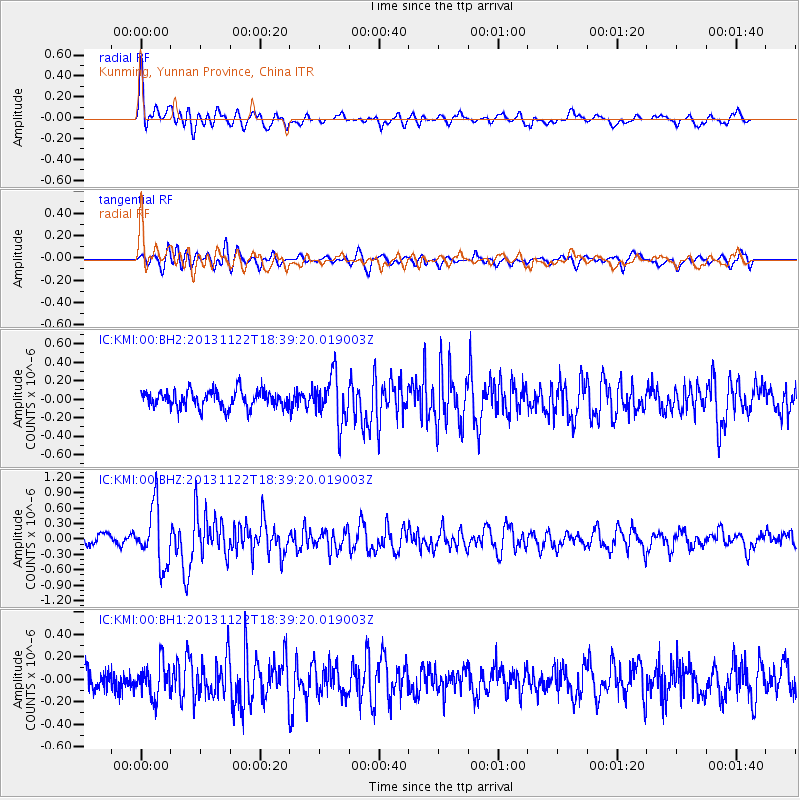
KMI Kunming, Yunnan Province, China - Earthquake Result Viewer
*The percent match for this event was below the threshold and hence no stack was calculated.
| Earthquake location: |
Iran-Iraq Border Region |
| Earthquake latitude/longitude: |
34.3/45.6 |
| Earthquake time(UTC): |
2013/11/22 (326) 18:30:58 GMT |
| Earthquake Depth: |
14 km |
| Earthquake Magnitude: |
5.8 MWW, 5.6 MWB, 5.8 MWC |
| Earthquake Catalog/Contributor: |
NEIC PDE/NEIC COMCAT |
|
| Network: |
IC New China Digital Seismograph Network |
| Station: |
KMI Kunming, Yunnan Province, China |
| Lat/Lon: |
25.12 N/102.74 E |
| Elevation: |
1975 m |
|
| Distance: |
49.9 deg |
| Az: |
84.488 deg |
| Baz: |
294.64 deg |
| Ray Param: |
$rayparam |
*The percent match for this event was below the threshold and hence was not used in the summary stack. |
|
| Radial Match: |
74.42526 % |
| Radial Bump: |
400 |
| Transverse Match: |
72.64844 % |
| Transverse Bump: |
400 |
| SOD ConfigId: |
626651 |
| Insert Time: |
2014-04-19 19:17:32.876 +0000 |
| GWidth: |
2.5 |
| Max Bumps: |
400 |
| Tol: |
0.001 |
|
Signal To Noise
| Channel | StoN | STA | LTA |
| IC:KMI:00:BHZ:20131122T18:39:20.019003Z | 6.0973725 | 5.672761E-7 | 9.303616E-8 |
| IC:KMI:00:BH1:20131122T18:39:20.019003Z | 1.7130606 | 1.4871665E-7 | 8.681343E-8 |
| IC:KMI:00:BH2:20131122T18:39:20.019003Z | 2.7623522 | 2.573681E-7 | 9.316991E-8 |
| Arrivals |
| Ps | |
| PpPs | |
| PsPs/PpSs | |


