You are here: Home > Network List > AZ - ANZA Regional Network Stations List
> Station SMER AZ.SMER > Earthquake Result Viewer
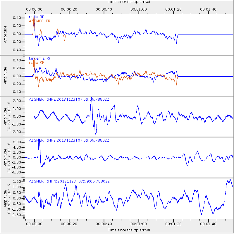
SMER AZ.SMER - Earthquake Result Viewer
*The percent match for this event was below the threshold and hence no stack was calculated.
| Earthquake location: |
Fiji Islands Region |
| Earthquake latitude/longitude: |
-17.1/-176.5 |
| Earthquake time(UTC): |
2013/11/23 (327) 07:48:32 GMT |
| Earthquake Depth: |
371 km |
| Earthquake Magnitude: |
6.5 MWW, 6.4 MI, 6.5 MWC, 6.5 MWB |
| Earthquake Catalog/Contributor: |
NEIC PDE/NEIC COMCAT |
|
| Network: |
AZ ANZA Regional Network |
| Station: |
SMER AZ.SMER |
| Lat/Lon: |
33.46 N/117.17 W |
| Elevation: |
355 m |
|
| Distance: |
75.7 deg |
| Az: |
47.93 deg |
| Baz: |
238.116 deg |
| Ray Param: |
$rayparam |
*The percent match for this event was below the threshold and hence was not used in the summary stack. |
|
| Radial Match: |
68.83094 % |
| Radial Bump: |
400 |
| Transverse Match: |
38.54689 % |
| Transverse Bump: |
400 |
| SOD ConfigId: |
626651 |
| Insert Time: |
2014-04-19 19:36:07.366 +0000 |
| GWidth: |
2.5 |
| Max Bumps: |
400 |
| Tol: |
0.001 |
|
Signal To Noise
| Channel | StoN | STA | LTA |
| AZ:SMER: :HHZ:20131123T07:59:06.78802Z | 9.779976 | 2.9720877E-6 | 3.038952E-7 |
| AZ:SMER: :HHN:20131123T07:59:06.78802Z | 0.98097056 | 3.8383135E-7 | 3.9127715E-7 |
| AZ:SMER: :HHE:20131123T07:59:06.78802Z | 2.6046891 | 9.900721E-7 | 3.8011143E-7 |
| Arrivals |
| Ps | |
| PpPs | |
| PsPs/PpSs | |


