You are here: Home > Network List > TA - USArray Transportable Network (new EarthScope stations) Stations List
> Station 121A Cookes Peak, Deming, NM, USA > Earthquake Result Viewer
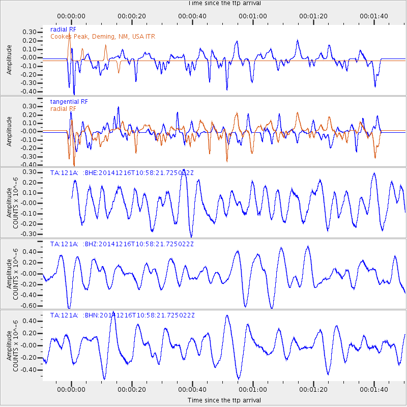
121A Cookes Peak, Deming, NM, USA - Earthquake Result Viewer
*The percent match for this event was below the threshold and hence no stack was calculated.
| Earthquake location: |
Pacific-Antarctic Ridge |
| Earthquake latitude/longitude: |
-56.8/-150.4 |
| Earthquake time(UTC): |
2014/12/16 (350) 10:45:26 GMT |
| Earthquake Depth: |
10 km |
| Earthquake Magnitude: |
5.5 MB |
| Earthquake Catalog/Contributor: |
NEIC PDE/NEIC COMCAT |
|
| Network: |
TA USArray Transportable Network (new EarthScope stations) |
| Station: |
121A Cookes Peak, Deming, NM, USA |
| Lat/Lon: |
32.53 N/107.79 W |
| Elevation: |
1652 m |
|
| Distance: |
96.1 deg |
| Az: |
35.127 deg |
| Baz: |
201.985 deg |
| Ray Param: |
$rayparam |
*The percent match for this event was below the threshold and hence was not used in the summary stack. |
|
| Radial Match: |
68.593895 % |
| Radial Bump: |
400 |
| Transverse Match: |
56.139004 % |
| Transverse Bump: |
400 |
| SOD ConfigId: |
3390531 |
| Insert Time: |
2019-04-15 14:01:08.059 +0000 |
| GWidth: |
2.5 |
| Max Bumps: |
400 |
| Tol: |
0.001 |
|
Signal To Noise
| Channel | StoN | STA | LTA |
| TA:121A: :BHZ:20141216T10:58:21.725022Z | 3.148389 | 3.1782193E-7 | 1.00947474E-7 |
| TA:121A: :BHN:20141216T10:58:21.725022Z | 0.9667436 | 1.7183157E-7 | 1.7774265E-7 |
| TA:121A: :BHE:20141216T10:58:21.725022Z | 1.0336243 | 1.112056E-7 | 1.0758803E-7 |
| Arrivals |
| Ps | |
| PpPs | |
| PsPs/PpSs | |


