You are here: Home > Network List > IU - Global Seismograph Network (GSN - IRIS/USGS) Stations List
> Station JOHN Johnston Island, USA > Earthquake Result Viewer
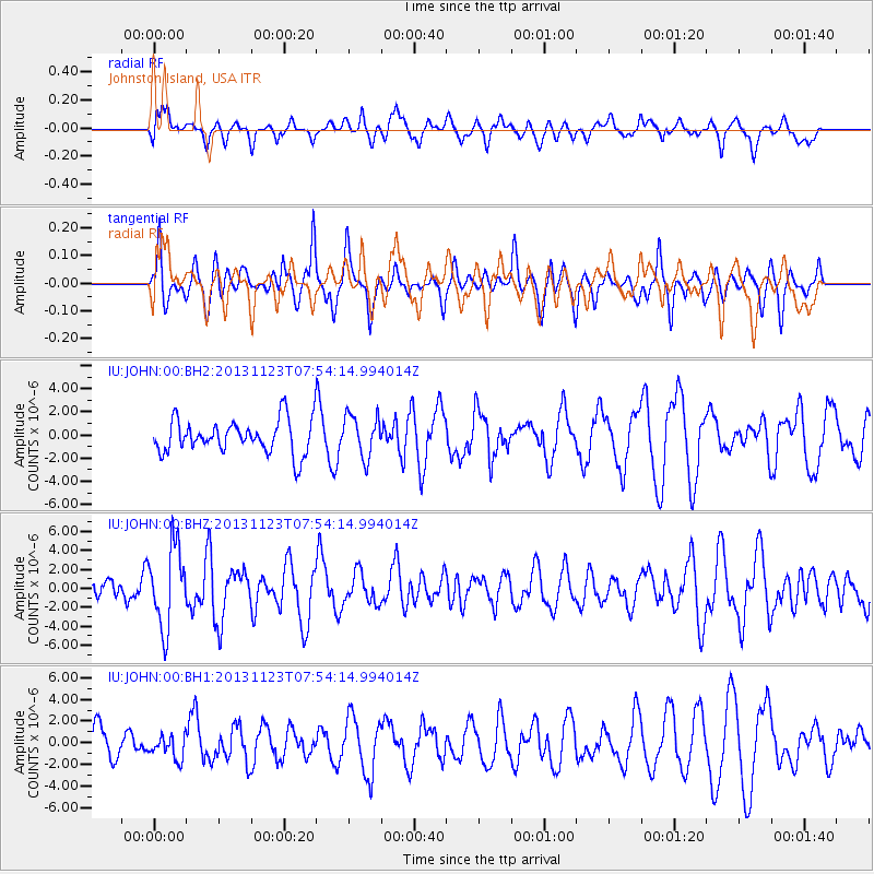
JOHN Johnston Island, USA - Earthquake Result Viewer
*The percent match for this event was below the threshold and hence no stack was calculated.
| Earthquake location: |
Fiji Islands Region |
| Earthquake latitude/longitude: |
-17.1/-176.5 |
| Earthquake time(UTC): |
2013/11/23 (327) 07:48:32 GMT |
| Earthquake Depth: |
371 km |
| Earthquake Magnitude: |
6.5 MWW, 6.4 MI, 6.5 MWC, 6.5 MWB |
| Earthquake Catalog/Contributor: |
NEIC PDE/NEIC COMCAT |
|
| Network: |
IU Global Seismograph Network (GSN - IRIS/USGS) |
| Station: |
JOHN Johnston Island, USA |
| Lat/Lon: |
16.73 N/169.53 W |
| Elevation: |
2.0 m |
|
| Distance: |
34.3 deg |
| Az: |
11.974 deg |
| Baz: |
191.95 deg |
| Ray Param: |
$rayparam |
*The percent match for this event was below the threshold and hence was not used in the summary stack. |
|
| Radial Match: |
41.707806 % |
| Radial Bump: |
400 |
| Transverse Match: |
42.217335 % |
| Transverse Bump: |
307 |
| SOD ConfigId: |
626651 |
| Insert Time: |
2014-04-19 19:42:25.603 +0000 |
| GWidth: |
2.5 |
| Max Bumps: |
400 |
| Tol: |
0.001 |
|
Signal To Noise
| Channel | StoN | STA | LTA |
| IU:JOHN:00:BHZ:20131123T07:54:14.994014Z | 3.4707496 | 4.199597E-6 | 1.2099971E-6 |
| IU:JOHN:00:BH1:20131123T07:54:14.994014Z | 0.58893293 | 1.0544352E-6 | 1.7904164E-6 |
| IU:JOHN:00:BH2:20131123T07:54:14.994014Z | 1.2540091 | 1.8175627E-6 | 1.4494015E-6 |
| Arrivals |
| Ps | |
| PpPs | |
| PsPs/PpSs | |


