You are here: Home > Network List > US - United States National Seismic Network Stations List
> Station MSO Missoula, Montana, USA > Earthquake Result Viewer
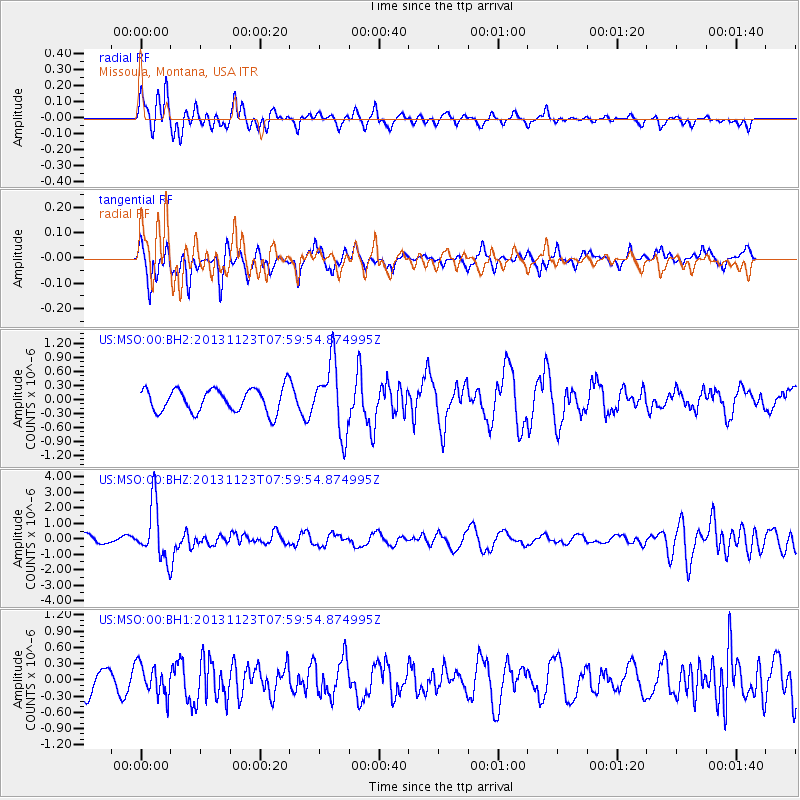
MSO Missoula, Montana, USA - Earthquake Result Viewer
*The percent match for this event was below the threshold and hence no stack was calculated.
| Earthquake location: |
Fiji Islands Region |
| Earthquake latitude/longitude: |
-17.1/-176.5 |
| Earthquake time(UTC): |
2013/11/23 (327) 07:48:32 GMT |
| Earthquake Depth: |
371 km |
| Earthquake Magnitude: |
6.5 MWW, 6.4 MI, 6.5 MWC, 6.5 MWB |
| Earthquake Catalog/Contributor: |
NEIC PDE/NEIC COMCAT |
|
| Network: |
US United States National Seismic Network |
| Station: |
MSO Missoula, Montana, USA |
| Lat/Lon: |
46.83 N/113.94 W |
| Elevation: |
1264 m |
|
| Distance: |
84.9 deg |
| Az: |
37.739 deg |
| Baz: |
238.477 deg |
| Ray Param: |
$rayparam |
*The percent match for this event was below the threshold and hence was not used in the summary stack. |
|
| Radial Match: |
68.473564 % |
| Radial Bump: |
400 |
| Transverse Match: |
63.722317 % |
| Transverse Bump: |
376 |
| SOD ConfigId: |
626651 |
| Insert Time: |
2014-04-19 19:52:28.922 +0000 |
| GWidth: |
2.5 |
| Max Bumps: |
400 |
| Tol: |
0.001 |
|
Signal To Noise
| Channel | StoN | STA | LTA |
| US:MSO:00:BHZ:20131123T07:59:54.874995Z | 4.977016 | 1.7973808E-6 | 3.6113624E-7 |
| US:MSO:00:BH1:20131123T07:59:54.874995Z | 1.19154 | 2.8794423E-7 | 2.416572E-7 |
| US:MSO:00:BH2:20131123T07:59:54.874995Z | 2.9790802 | 7.4830047E-7 | 2.5118507E-7 |
| Arrivals |
| Ps | |
| PpPs | |
| PsPs/PpSs | |


