You are here: Home > Network List > WY - Yellowstone Wyoming Seismic Network Stations List
> Station YHH Holmes Hill, YNP, WY, USA > Earthquake Result Viewer
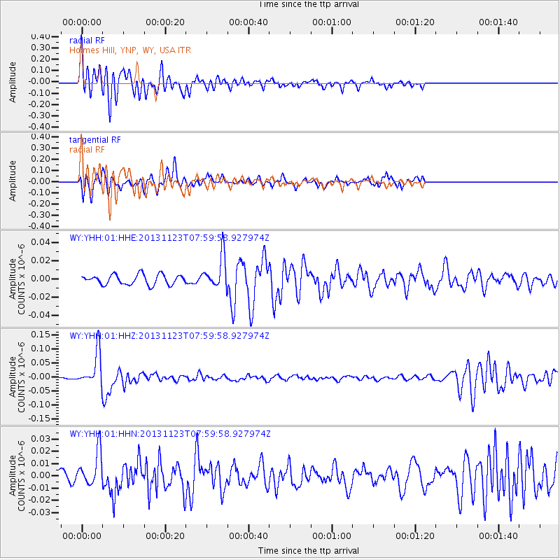
YHH Holmes Hill, YNP, WY, USA - Earthquake Result Viewer
*The percent match for this event was below the threshold and hence no stack was calculated.
| Earthquake location: |
Fiji Islands Region |
| Earthquake latitude/longitude: |
-17.1/-176.5 |
| Earthquake time(UTC): |
2013/11/23 (327) 07:48:32 GMT |
| Earthquake Depth: |
371 km |
| Earthquake Magnitude: |
6.5 MWW, 6.4 MI, 6.5 MWC, 6.5 MWB |
| Earthquake Catalog/Contributor: |
NEIC PDE/NEIC COMCAT |
|
| Network: |
WY Yellowstone Wyoming Seismic Network |
| Station: |
YHH Holmes Hill, YNP, WY, USA |
| Lat/Lon: |
44.79 N/110.85 W |
| Elevation: |
2717 m |
|
| Distance: |
85.7 deg |
| Az: |
40.601 deg |
| Baz: |
240.921 deg |
| Ray Param: |
$rayparam |
*The percent match for this event was below the threshold and hence was not used in the summary stack. |
|
| Radial Match: |
79.09871 % |
| Radial Bump: |
400 |
| Transverse Match: |
79.58331 % |
| Transverse Bump: |
400 |
| SOD ConfigId: |
626651 |
| Insert Time: |
2014-04-19 19:55:18.692 +0000 |
| GWidth: |
2.5 |
| Max Bumps: |
400 |
| Tol: |
0.001 |
|
Signal To Noise
| Channel | StoN | STA | LTA |
| WY:YHH:01:HHZ:20131123T07:59:58.927974Z | 19.56339 | 6.244046E-8 | 3.1916993E-9 |
| WY:YHH:01:HHN:20131123T07:59:58.927974Z | 2.570226 | 1.4718857E-8 | 5.7266782E-9 |
| WY:YHH:01:HHE:20131123T07:59:58.927974Z | 3.3662033 | 1.8453726E-8 | 5.4820593E-9 |
| Arrivals |
| Ps | |
| PpPs | |
| PsPs/PpSs | |


