You are here: Home > Network List > PF - Volcanologic Network of Piton de Fournaise-OVPF Stations List
> Station HIM cratere Himiltrude > Earthquake Result Viewer
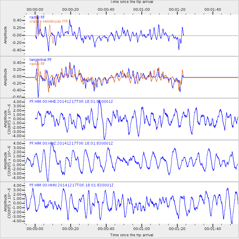
HIM cratere Himiltrude - Earthquake Result Viewer
*The percent match for this event was below the threshold and hence no stack was calculated.
| Earthquake location: |
Southern Sumatra, Indonesia |
| Earthquake latitude/longitude: |
-3.9/100.1 |
| Earthquake time(UTC): |
2014/12/17 (351) 06:10:05 GMT |
| Earthquake Depth: |
10 km |
| Earthquake Magnitude: |
5.6 MB |
| Earthquake Catalog/Contributor: |
NEIC PDE/NEIC COMCAT |
|
| Network: |
PF Volcanologic Network of Piton de Fournaise-OVPF |
| Station: |
HIM cratere Himiltrude |
| Lat/Lon: |
21.21 S/55.72 E |
| Elevation: |
1958 m |
|
| Distance: |
46.4 deg |
| Az: |
244.356 deg |
| Baz: |
74.563 deg |
| Ray Param: |
$rayparam |
*The percent match for this event was below the threshold and hence was not used in the summary stack. |
|
| Radial Match: |
71.50586 % |
| Radial Bump: |
400 |
| Transverse Match: |
63.945107 % |
| Transverse Bump: |
400 |
| SOD ConfigId: |
3390531 |
| Insert Time: |
2019-04-15 14:16:31.096 +0000 |
| GWidth: |
2.5 |
| Max Bumps: |
400 |
| Tol: |
0.001 |
|
Signal To Noise
| Channel | StoN | STA | LTA |
| PF:HIM:00:HHZ:20141217T06:18:01.830001Z | 1.833784 | 1.5777766E-6 | 8.60394E-7 |
| PF:HIM:00:HHN:20141217T06:18:01.830001Z | 1.6118898 | 1.5614727E-6 | 9.687217E-7 |
| PF:HIM:00:HHE:20141217T06:18:01.830001Z | 1.0513247 | 1.2807739E-6 | 1.2182476E-6 |
| Arrivals |
| Ps | |
| PpPs | |
| PsPs/PpSs | |


