You are here: Home > Network List > G - GEOSCOPE Stations List
> Station NOUC Port Laguerre, New Caledonia > Earthquake Result Viewer
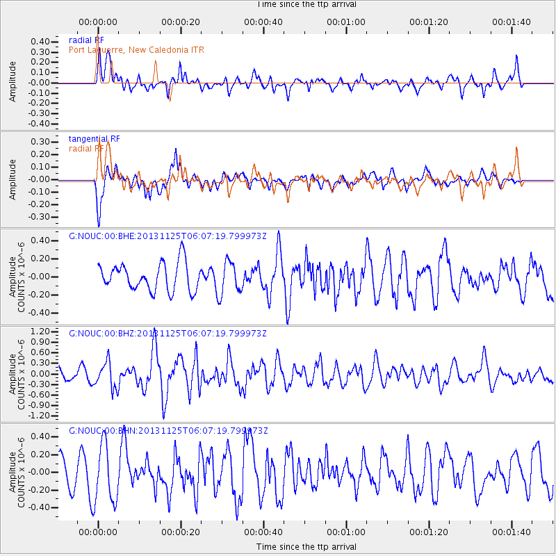
NOUC Port Laguerre, New Caledonia - Earthquake Result Viewer
*The percent match for this event was below the threshold and hence no stack was calculated.
| Earthquake location: |
Kuril Islands |
| Earthquake latitude/longitude: |
45.6/151.0 |
| Earthquake time(UTC): |
2013/11/25 (329) 05:56:50 GMT |
| Earthquake Depth: |
34 km |
| Earthquake Magnitude: |
6.0 MWW, 5.8 MWB, 6.0 MWC |
| Earthquake Catalog/Contributor: |
NEIC PDE/NEIC COMCAT |
|
| Network: |
G GEOSCOPE |
| Station: |
NOUC Port Laguerre, New Caledonia |
| Lat/Lon: |
22.10 S/166.30 E |
| Elevation: |
112 m |
|
| Distance: |
68.8 deg |
| Az: |
164.781 deg |
| Baz: |
348.529 deg |
| Ray Param: |
$rayparam |
*The percent match for this event was below the threshold and hence was not used in the summary stack. |
|
| Radial Match: |
64.401566 % |
| Radial Bump: |
400 |
| Transverse Match: |
71.18359 % |
| Transverse Bump: |
400 |
| SOD ConfigId: |
626651 |
| Insert Time: |
2014-04-19 20:06:41.232 +0000 |
| GWidth: |
2.5 |
| Max Bumps: |
400 |
| Tol: |
0.001 |
|
Signal To Noise
| Channel | StoN | STA | LTA |
| G:NOUC:00:BHZ:20131125T06:07:19.799973Z | 2.0660257 | 3.8081606E-7 | 1.84323E-7 |
| G:NOUC:00:BHN:20131125T06:07:19.799973Z | 2.3285656 | 3.2629364E-7 | 1.4012645E-7 |
| G:NOUC:00:BHE:20131125T06:07:19.799973Z | 1.2155746 | 1.8299804E-7 | 1.5054447E-7 |
| Arrivals |
| Ps | |
| PpPs | |
| PsPs/PpSs | |


