You are here: Home > Network List > TA - USArray Transportable Network (new EarthScope stations) Stations List
> Station G59A Clarenceville, QC, USA > Earthquake Result Viewer
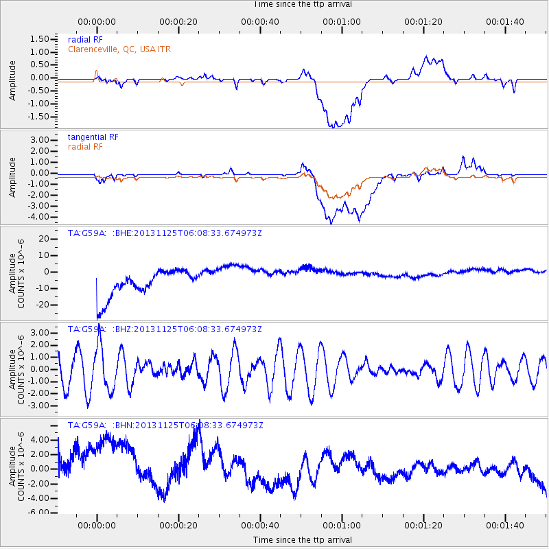
G59A Clarenceville, QC, USA - Earthquake Result Viewer
*The percent match for this event was below the threshold and hence no stack was calculated.
| Earthquake location: |
Kuril Islands |
| Earthquake latitude/longitude: |
45.6/151.0 |
| Earthquake time(UTC): |
2013/11/25 (329) 05:56:50 GMT |
| Earthquake Depth: |
34 km |
| Earthquake Magnitude: |
6.0 MWW, 5.8 MWB, 6.0 MWC |
| Earthquake Catalog/Contributor: |
NEIC PDE/NEIC COMCAT |
|
| Network: |
TA USArray Transportable Network (new EarthScope stations) |
| Station: |
G59A Clarenceville, QC, USA |
| Lat/Lon: |
45.08 N/73.18 W |
| Elevation: |
36 m |
|
| Distance: |
81.6 deg |
| Az: |
29.94 deg |
| Baz: |
330.336 deg |
| Ray Param: |
$rayparam |
*The percent match for this event was below the threshold and hence was not used in the summary stack. |
|
| Radial Match: |
22.813839 % |
| Radial Bump: |
400 |
| Transverse Match: |
26.47424 % |
| Transverse Bump: |
400 |
| SOD ConfigId: |
626651 |
| Insert Time: |
2014-04-19 20:20:58.646 +0000 |
| GWidth: |
2.5 |
| Max Bumps: |
400 |
| Tol: |
0.001 |
|
Signal To Noise
| Channel | StoN | STA | LTA |
| TA:G59A: :BHZ:20131125T06:08:33.674973Z | 1.2220954 | 1.8117033E-6 | 1.4824566E-6 |
| TA:G59A: :BHN:20131125T06:08:33.674973Z | 1.0668964 | 1.1706538E-5 | 1.0972516E-5 |
| TA:G59A: :BHE:20131125T06:08:33.674973Z | 1.3352841 | 1.0294178E-5 | 7.709354E-6 |
| Arrivals |
| Ps | |
| PpPs | |
| PsPs/PpSs | |


