You are here: Home > Network List > US - United States National Seismic Network Stations List
> Station AMTX Amarillo, Texas, USA > Earthquake Result Viewer
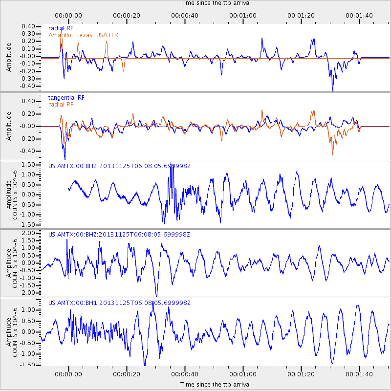
AMTX Amarillo, Texas, USA - Earthquake Result Viewer
*The percent match for this event was below the threshold and hence no stack was calculated.
| Earthquake location: |
Kuril Islands |
| Earthquake latitude/longitude: |
45.6/151.0 |
| Earthquake time(UTC): |
2013/11/25 (329) 05:56:50 GMT |
| Earthquake Depth: |
34 km |
| Earthquake Magnitude: |
6.0 MWW, 5.8 MWB, 6.0 MWC |
| Earthquake Catalog/Contributor: |
NEIC PDE/NEIC COMCAT |
|
| Network: |
US United States National Seismic Network |
| Station: |
AMTX Amarillo, Texas, USA |
| Lat/Lon: |
34.53 N/101.41 W |
| Elevation: |
1010 m |
|
| Distance: |
76.9 deg |
| Az: |
53.898 deg |
| Baz: |
316.564 deg |
| Ray Param: |
$rayparam |
*The percent match for this event was below the threshold and hence was not used in the summary stack. |
|
| Radial Match: |
56.95687 % |
| Radial Bump: |
400 |
| Transverse Match: |
66.86633 % |
| Transverse Bump: |
400 |
| SOD ConfigId: |
626651 |
| Insert Time: |
2014-04-19 20:28:08.193 +0000 |
| GWidth: |
2.5 |
| Max Bumps: |
400 |
| Tol: |
0.001 |
|
Signal To Noise
| Channel | StoN | STA | LTA |
| US:AMTX:00:BHZ:20131125T06:08:05.699998Z | 1.2247308 | 6.604151E-7 | 5.392328E-7 |
| US:AMTX:00:BH1:20131125T06:08:05.699998Z | 1.0300713 | 5.0209735E-7 | 4.874394E-7 |
| US:AMTX:00:BH2:20131125T06:08:05.699998Z | 2.3913503 | 8.067022E-7 | 3.373417E-7 |
| Arrivals |
| Ps | |
| PpPs | |
| PsPs/PpSs | |


