You are here: Home > Network List > WY - Yellowstone Wyoming Seismic Network Stations List
> Station YHH Holmes Hill, YNP, WY, USA > Earthquake Result Viewer
YHH Holmes Hill, YNP, WY, USA - Earthquake Result Viewer
*The percent match for this event was below the threshold and hence no stack was calculated.
| Earthquake location: |
Kuril Islands |
| Earthquake latitude/longitude: |
45.6/151.0 |
| Earthquake time(UTC): |
2013/11/25 (329) 05:56:50 GMT |
| Earthquake Depth: |
34 km |
| Earthquake Magnitude: |
6.0 MWW, 5.8 MWB, 6.0 MWC |
| Earthquake Catalog/Contributor: |
NEIC PDE/NEIC COMCAT |
|
| Network: |
WY Yellowstone Wyoming Seismic Network |
| Station: |
YHH Holmes Hill, YNP, WY, USA |
| Lat/Lon: |
44.79 N/110.85 W |
| Elevation: |
2717 m |
|
| Distance: |
64.6 deg |
| Az: |
51.284 deg |
| Baz: |
309.663 deg |
| Ray Param: |
$rayparam |
*The percent match for this event was below the threshold and hence was not used in the summary stack. |
|
| Radial Match: |
63.310703 % |
| Radial Bump: |
400 |
| Transverse Match: |
78.64859 % |
| Transverse Bump: |
357 |
| SOD ConfigId: |
626651 |
| Insert Time: |
2014-04-19 20:30:58.424 +0000 |
| GWidth: |
2.5 |
| Max Bumps: |
400 |
| Tol: |
0.001 |
|
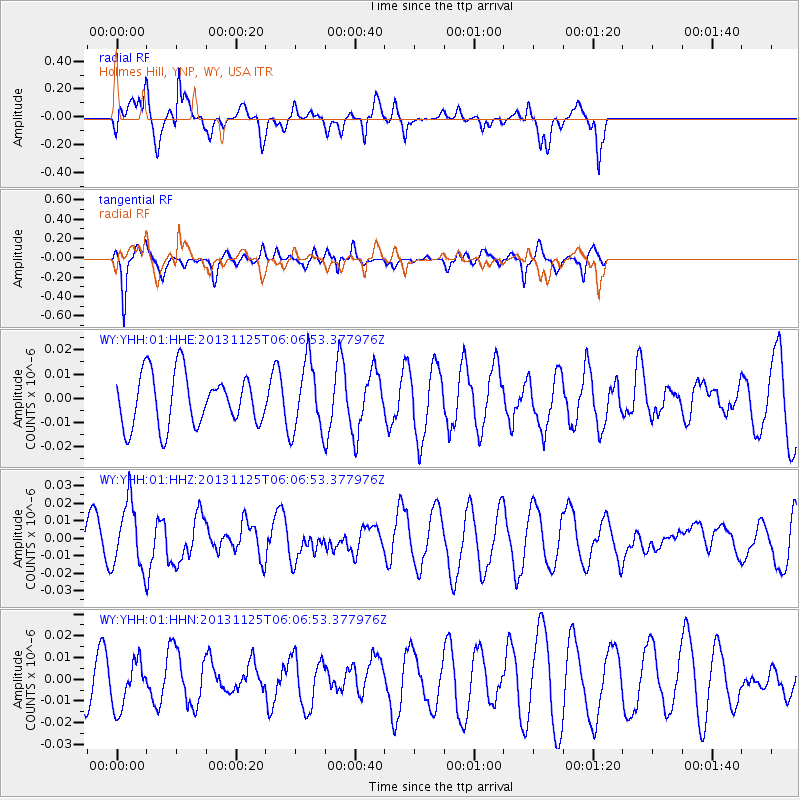
Signal To Noise
| Channel | StoN | STA | LTA |
| WY:YHH:01:HHZ:20131125T06:06:53.377976Z | 1.808315 | 1.8652841E-8 | 1.03150395E-8 |
| WY:YHH:01:HHN:20131125T06:06:53.377976Z | 1.0038979 | 1.0937858E-8 | 1.08953895E-8 |
| WY:YHH:01:HHE:20131125T06:06:53.377976Z | 1.3478483 | 1.4431075E-8 | 1.070675E-8 |
| Arrivals |
| Ps | |
| PpPs | |
| PsPs/PpSs | |


