You are here: Home > Network List > TA - USArray Transportable Network (new EarthScope stations) Stations List
> Station Q58A Fox Den Farm, The Plains, VA, USA > Earthquake Result Viewer
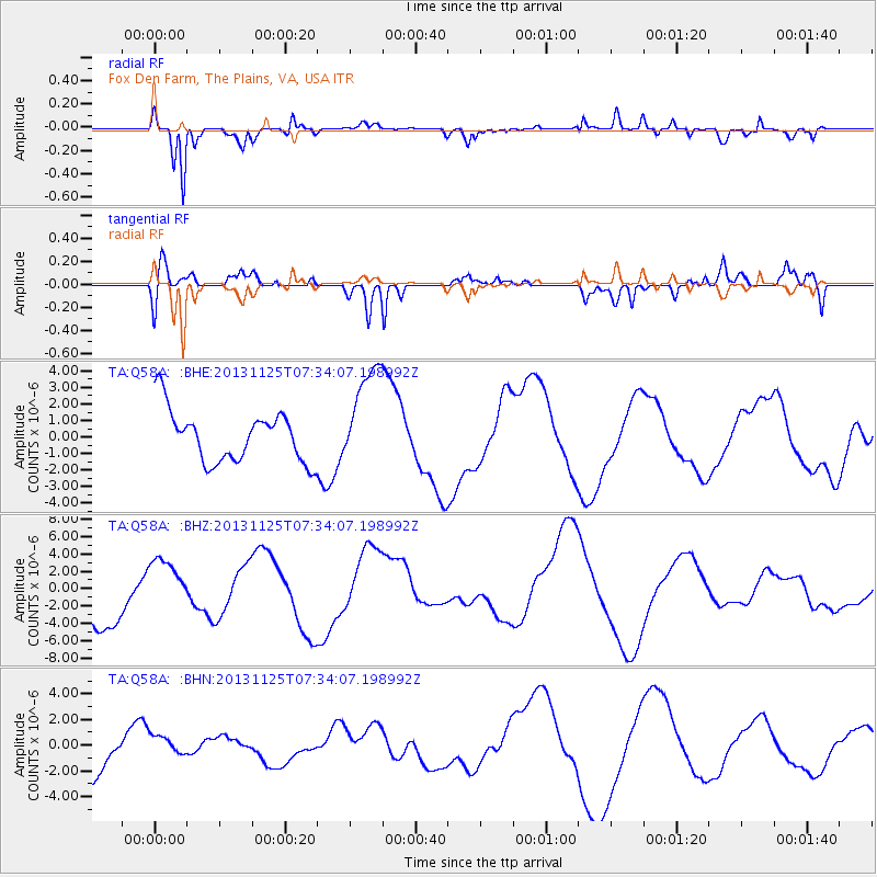
Q58A Fox Den Farm, The Plains, VA, USA - Earthquake Result Viewer
*The percent match for this event was below the threshold and hence no stack was calculated.
| Earthquake location: |
South Atlantic Ocean |
| Earthquake latitude/longitude: |
-53.9/-53.9 |
| Earthquake time(UTC): |
2013/11/25 (329) 07:21:18 GMT |
| Earthquake Depth: |
15 km |
| Earthquake Magnitude: |
6.0 MWC, 6.0 MWC |
| Earthquake Catalog/Contributor: |
NEIC PDE/NEIC COMCAT |
|
| Network: |
TA USArray Transportable Network (new EarthScope stations) |
| Station: |
Q58A Fox Den Farm, The Plains, VA, USA |
| Lat/Lon: |
38.94 N/77.68 W |
| Elevation: |
182 m |
|
| Distance: |
94.7 deg |
| Az: |
341.615 deg |
| Baz: |
166.143 deg |
| Ray Param: |
$rayparam |
*The percent match for this event was below the threshold and hence was not used in the summary stack. |
|
| Radial Match: |
83.04443 % |
| Radial Bump: |
400 |
| Transverse Match: |
56.91727 % |
| Transverse Bump: |
400 |
| SOD ConfigId: |
626651 |
| Insert Time: |
2014-04-19 20:52:28.391 +0000 |
| GWidth: |
2.5 |
| Max Bumps: |
400 |
| Tol: |
0.001 |
|
Signal To Noise
| Channel | StoN | STA | LTA |
| TA:Q58A: :BHZ:20131125T07:34:07.198992Z | 1.1006243 | 3.2838004E-6 | 2.9835799E-6 |
| TA:Q58A: :BHN:20131125T07:34:07.198992Z | 0.5211976 | 8.7896177E-7 | 1.686427E-6 |
| TA:Q58A: :BHE:20131125T07:34:07.198992Z | 2.0266495 | 3.1515322E-6 | 1.5550456E-6 |
| Arrivals |
| Ps | |
| PpPs | |
| PsPs/PpSs | |


