You are here: Home > Network List > AV - Alaska Volcano Observatory Stations List
> Station SPCR Ckakachatna River, Mount Spurr, Alaska > Earthquake Result Viewer
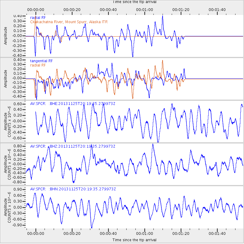
SPCR Ckakachatna River, Mount Spurr, Alaska - Earthquake Result Viewer
*The percent match for this event was below the threshold and hence no stack was calculated.
| Earthquake location: |
Near Coast Of Peru |
| Earthquake latitude/longitude: |
-12.6/-76.2 |
| Earthquake time(UTC): |
2013/11/25 (329) 20:06:55 GMT |
| Earthquake Depth: |
77 km |
| Earthquake Magnitude: |
5.5 MWB, 5.5 MWC |
| Earthquake Catalog/Contributor: |
NEIC PDE/NEIC COMCAT |
|
| Network: |
AV Alaska Volcano Observatory |
| Station: |
SPCR Ckakachatna River, Mount Spurr, Alaska |
| Lat/Lon: |
61.20 N/152.21 W |
| Elevation: |
984 m |
|
| Distance: |
94.3 deg |
| Az: |
331.887 deg |
| Baz: |
108.203 deg |
| Ray Param: |
$rayparam |
*The percent match for this event was below the threshold and hence was not used in the summary stack. |
|
| Radial Match: |
54.684025 % |
| Radial Bump: |
400 |
| Transverse Match: |
53.78619 % |
| Transverse Bump: |
398 |
| SOD ConfigId: |
626651 |
| Insert Time: |
2014-04-19 20:57:16.691 +0000 |
| GWidth: |
2.5 |
| Max Bumps: |
400 |
| Tol: |
0.001 |
|
Signal To Noise
| Channel | StoN | STA | LTA |
| AV:SPCR: :BHZ:20131125T20:19:35.279973Z | 0.77078515 | 1.882728E-7 | 2.4426103E-7 |
| AV:SPCR: :BHN:20131125T20:19:35.279973Z | 2.5105975 | 5.7344874E-7 | 2.2841127E-7 |
| AV:SPCR: :BHE:20131125T20:19:35.279973Z | 1.4650186 | 4.0941524E-7 | 2.7946078E-7 |
| Arrivals |
| Ps | |
| PpPs | |
| PsPs/PpSs | |


