You are here: Home > Network List > TA - USArray Transportable Network (new EarthScope stations) Stations List
> Station U49A Red Boiling Springs, TN, USA > Earthquake Result Viewer
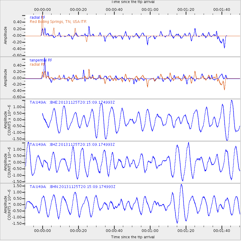
U49A Red Boiling Springs, TN, USA - Earthquake Result Viewer
*The percent match for this event was below the threshold and hence no stack was calculated.
| Earthquake location: |
Near Coast Of Peru |
| Earthquake latitude/longitude: |
-12.6/-76.2 |
| Earthquake time(UTC): |
2013/11/25 (329) 20:06:55 GMT |
| Earthquake Depth: |
77 km |
| Earthquake Magnitude: |
5.5 MWB, 5.5 MWC |
| Earthquake Catalog/Contributor: |
NEIC PDE/NEIC COMCAT |
|
| Network: |
TA USArray Transportable Network (new EarthScope stations) |
| Station: |
U49A Red Boiling Springs, TN, USA |
| Lat/Lon: |
36.51 N/85.78 W |
| Elevation: |
234 m |
|
| Distance: |
49.7 deg |
| Az: |
349.874 deg |
| Baz: |
167.699 deg |
| Ray Param: |
$rayparam |
*The percent match for this event was below the threshold and hence was not used in the summary stack. |
|
| Radial Match: |
52.11141 % |
| Radial Bump: |
400 |
| Transverse Match: |
59.550472 % |
| Transverse Bump: |
282 |
| SOD ConfigId: |
626651 |
| Insert Time: |
2014-04-19 21:16:22.947 +0000 |
| GWidth: |
2.5 |
| Max Bumps: |
400 |
| Tol: |
0.001 |
|
Signal To Noise
| Channel | StoN | STA | LTA |
| TA:U49A: :BHZ:20131125T20:15:09.174993Z | 0.3218301 | 2.6907506E-7 | 8.36078E-7 |
| TA:U49A: :BHN:20131125T20:15:09.174993Z | 1.2152137 | 5.7191346E-7 | 4.7062787E-7 |
| TA:U49A: :BHE:20131125T20:15:09.174993Z | 1.8144683 | 9.4657696E-7 | 5.2168286E-7 |
| Arrivals |
| Ps | |
| PpPs | |
| PsPs/PpSs | |


