You are here: Home > Network List > TA - USArray Transportable Network (new EarthScope stations) Stations List
> Station U52A Thorn Hill, TN, USA > Earthquake Result Viewer
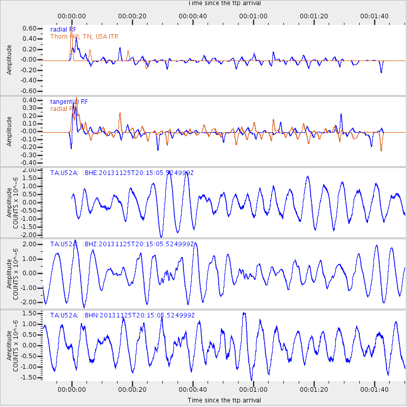
U52A Thorn Hill, TN, USA - Earthquake Result Viewer
*The percent match for this event was below the threshold and hence no stack was calculated.
| Earthquake location: |
Near Coast Of Peru |
| Earthquake latitude/longitude: |
-12.6/-76.2 |
| Earthquake time(UTC): |
2013/11/25 (329) 20:06:55 GMT |
| Earthquake Depth: |
77 km |
| Earthquake Magnitude: |
5.5 MWB, 5.5 MWC |
| Earthquake Catalog/Contributor: |
NEIC PDE/NEIC COMCAT |
|
| Network: |
TA USArray Transportable Network (new EarthScope stations) |
| Station: |
U52A Thorn Hill, TN, USA |
| Lat/Lon: |
36.39 N/83.37 W |
| Elevation: |
510 m |
|
| Distance: |
49.2 deg |
| Az: |
352.36 deg |
| Baz: |
170.743 deg |
| Ray Param: |
$rayparam |
*The percent match for this event was below the threshold and hence was not used in the summary stack. |
|
| Radial Match: |
64.048035 % |
| Radial Bump: |
400 |
| Transverse Match: |
63.431255 % |
| Transverse Bump: |
389 |
| SOD ConfigId: |
626651 |
| Insert Time: |
2014-04-19 21:16:28.062 +0000 |
| GWidth: |
2.5 |
| Max Bumps: |
400 |
| Tol: |
0.001 |
|
Signal To Noise
| Channel | StoN | STA | LTA |
| TA:U52A: :BHZ:20131125T20:15:05.524999Z | 1.0980098 | 1.5514868E-6 | 1.412999E-6 |
| TA:U52A: :BHN:20131125T20:15:05.524999Z | 0.84578574 | 6.624265E-7 | 7.832084E-7 |
| TA:U52A: :BHE:20131125T20:15:05.524999Z | 2.9065866 | 1.4726415E-6 | 5.0665665E-7 |
| Arrivals |
| Ps | |
| PpPs | |
| PsPs/PpSs | |


