You are here: Home > Network List > US - United States National Seismic Network Stations List
> Station EGMT Eagleton, Montana, USA > Earthquake Result Viewer
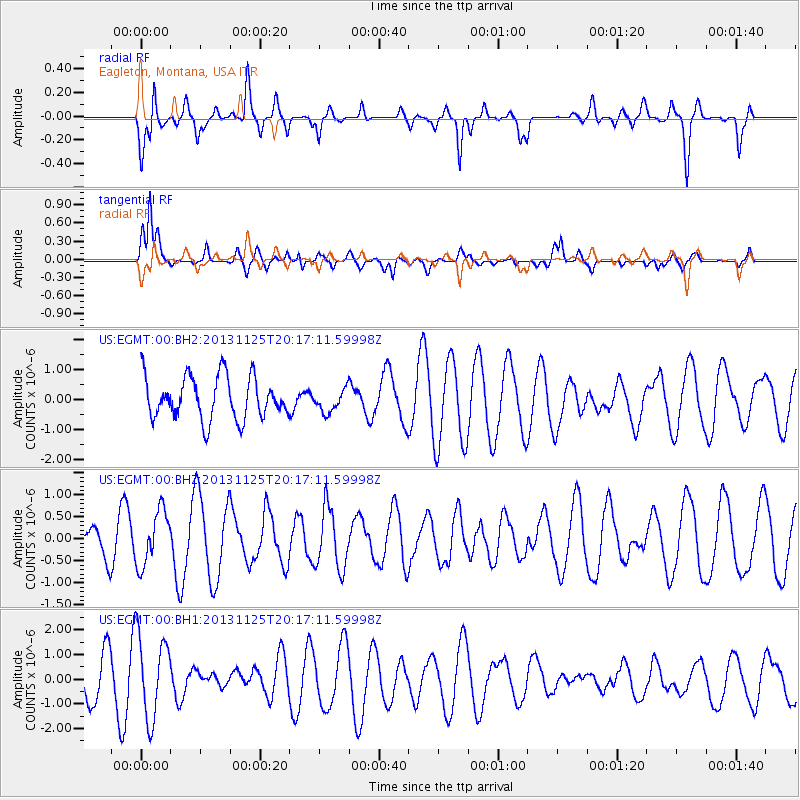
EGMT Eagleton, Montana, USA - Earthquake Result Viewer
*The percent match for this event was below the threshold and hence no stack was calculated.
| Earthquake location: |
Near Coast Of Peru |
| Earthquake latitude/longitude: |
-12.6/-76.2 |
| Earthquake time(UTC): |
2013/11/25 (329) 20:06:55 GMT |
| Earthquake Depth: |
77 km |
| Earthquake Magnitude: |
5.5 MWB, 5.5 MWC |
| Earthquake Catalog/Contributor: |
NEIC PDE/NEIC COMCAT |
|
| Network: |
US United States National Seismic Network |
| Station: |
EGMT Eagleton, Montana, USA |
| Lat/Lon: |
48.02 N/109.75 W |
| Elevation: |
1055 m |
|
| Distance: |
67.3 deg |
| Az: |
336.29 deg |
| Baz: |
144.214 deg |
| Ray Param: |
$rayparam |
*The percent match for this event was below the threshold and hence was not used in the summary stack. |
|
| Radial Match: |
30.90967 % |
| Radial Bump: |
238 |
| Transverse Match: |
67.06278 % |
| Transverse Bump: |
400 |
| SOD ConfigId: |
626651 |
| Insert Time: |
2014-04-19 21:18:09.560 +0000 |
| GWidth: |
2.5 |
| Max Bumps: |
400 |
| Tol: |
0.001 |
|
Signal To Noise
| Channel | StoN | STA | LTA |
| US:EGMT:00:BHZ:20131125T20:17:11.59998Z | 2.7765253 | 6.213864E-7 | 2.2380001E-7 |
| US:EGMT:00:BH1:20131125T20:17:11.59998Z | 1.7017245 | 1.6922404E-6 | 9.944267E-7 |
| US:EGMT:00:BH2:20131125T20:17:11.59998Z | 0.53975195 | 3.7854483E-7 | 7.0133115E-7 |
| Arrivals |
| Ps | |
| PpPs | |
| PsPs/PpSs | |


