You are here: Home > Network List > US - United States National Seismic Network Stations List
> Station TPNV Topopah Spring, Nevada, USA > Earthquake Result Viewer
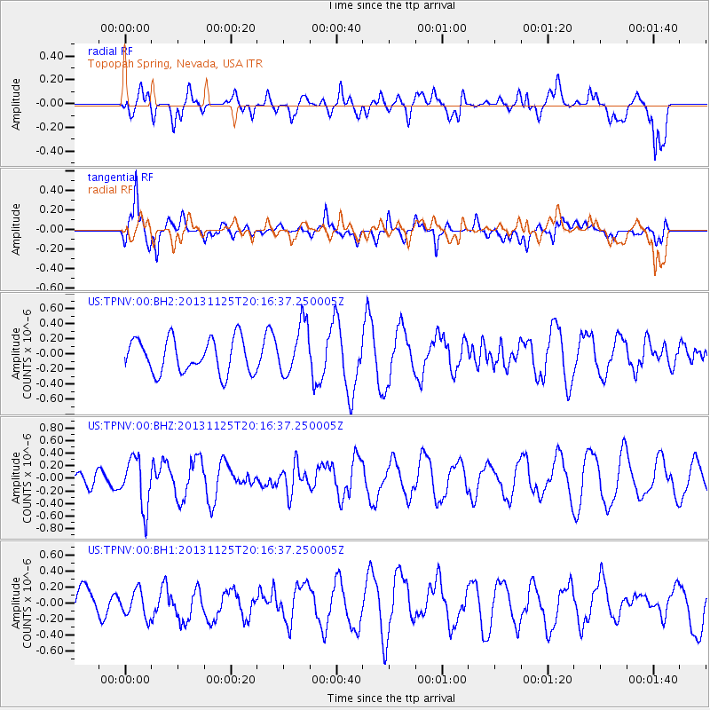
TPNV Topopah Spring, Nevada, USA - Earthquake Result Viewer
*The percent match for this event was below the threshold and hence no stack was calculated.
| Earthquake location: |
Near Coast Of Peru |
| Earthquake latitude/longitude: |
-12.6/-76.2 |
| Earthquake time(UTC): |
2013/11/25 (329) 20:06:55 GMT |
| Earthquake Depth: |
77 km |
| Earthquake Magnitude: |
5.5 MWB, 5.5 MWC |
| Earthquake Catalog/Contributor: |
NEIC PDE/NEIC COMCAT |
|
| Network: |
US United States National Seismic Network |
| Station: |
TPNV Topopah Spring, Nevada, USA |
| Lat/Lon: |
36.95 N/116.25 W |
| Elevation: |
1600 m |
|
| Distance: |
62.0 deg |
| Az: |
324.296 deg |
| Baz: |
134.67 deg |
| Ray Param: |
$rayparam |
*The percent match for this event was below the threshold and hence was not used in the summary stack. |
|
| Radial Match: |
44.340427 % |
| Radial Bump: |
400 |
| Transverse Match: |
66.8612 % |
| Transverse Bump: |
400 |
| SOD ConfigId: |
626651 |
| Insert Time: |
2014-04-19 21:18:44.202 +0000 |
| GWidth: |
2.5 |
| Max Bumps: |
400 |
| Tol: |
0.001 |
|
Signal To Noise
| Channel | StoN | STA | LTA |
| US:TPNV:00:BHZ:20131125T20:16:37.250005Z | 1.8390601 | 3.9849257E-7 | 2.1668274E-7 |
| US:TPNV:00:BH1:20131125T20:16:37.250005Z | 0.3856653 | 1.6694493E-7 | 4.3287517E-7 |
| US:TPNV:00:BH2:20131125T20:16:37.250005Z | 1.5421966 | 3.4285088E-7 | 2.2231335E-7 |
| Arrivals |
| Ps | |
| PpPs | |
| PsPs/PpSs | |


