You are here: Home > Network List > TA - USArray Transportable Network (new EarthScope stations) Stations List
> Station J01E Myrtle Point, OR, USA > Earthquake Result Viewer
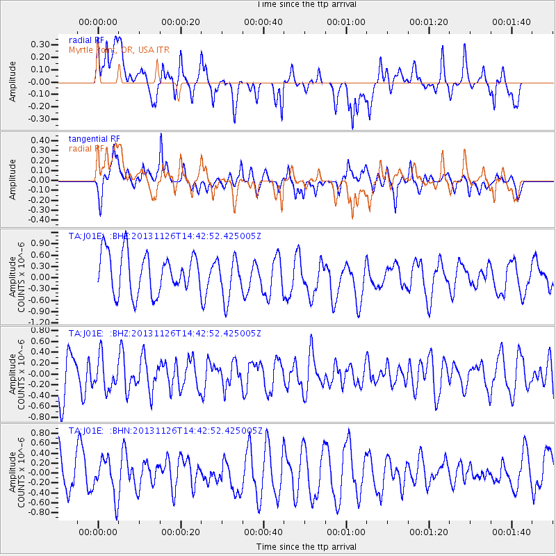
J01E Myrtle Point, OR, USA - Earthquake Result Viewer
*The percent match for this event was below the threshold and hence no stack was calculated.
| Earthquake location: |
New Britain Region, P.N.G. |
| Earthquake latitude/longitude: |
-5.8/150.8 |
| Earthquake time(UTC): |
2013/11/26 (330) 14:30:28 GMT |
| Earthquake Depth: |
61 km |
| Earthquake Magnitude: |
5.5 MWB, 5.4 MWC |
| Earthquake Catalog/Contributor: |
NEIC PDE/NEIC COMCAT |
|
| Network: |
TA USArray Transportable Network (new EarthScope stations) |
| Station: |
J01E Myrtle Point, OR, USA |
| Lat/Lon: |
43.16 N/123.93 W |
| Elevation: |
128 m |
|
| Distance: |
90.5 deg |
| Az: |
46.827 deg |
| Baz: |
262.571 deg |
| Ray Param: |
$rayparam |
*The percent match for this event was below the threshold and hence was not used in the summary stack. |
|
| Radial Match: |
57.680073 % |
| Radial Bump: |
400 |
| Transverse Match: |
54.36179 % |
| Transverse Bump: |
400 |
| SOD ConfigId: |
626651 |
| Insert Time: |
2014-04-19 21:31:54.761 +0000 |
| GWidth: |
2.5 |
| Max Bumps: |
400 |
| Tol: |
0.001 |
|
Signal To Noise
| Channel | StoN | STA | LTA |
| TA:J01E: :BHZ:20131126T14:42:52.425005Z | 0.5629384 | 3.006565E-7 | 5.340842E-7 |
| TA:J01E: :BHN:20131126T14:42:52.425005Z | 0.98861635 | 3.8904238E-7 | 3.935221E-7 |
| TA:J01E: :BHE:20131126T14:42:52.425005Z | 1.0416093 | 5.565957E-7 | 5.3436133E-7 |
| Arrivals |
| Ps | |
| PpPs | |
| PsPs/PpSs | |


