You are here: Home > Network List > TA - USArray Transportable Network (new EarthScope stations) Stations List
> Station O03E Paynes Creek, CA, USA > Earthquake Result Viewer
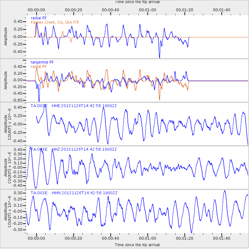
O03E Paynes Creek, CA, USA - Earthquake Result Viewer
*The percent match for this event was below the threshold and hence no stack was calculated.
| Earthquake location: |
New Britain Region, P.N.G. |
| Earthquake latitude/longitude: |
-5.8/150.8 |
| Earthquake time(UTC): |
2013/11/26 (330) 14:30:28 GMT |
| Earthquake Depth: |
61 km |
| Earthquake Magnitude: |
5.5 MWB, 5.4 MWC |
| Earthquake Catalog/Contributor: |
NEIC PDE/NEIC COMCAT |
|
| Network: |
TA USArray Transportable Network (new EarthScope stations) |
| Station: |
O03E Paynes Creek, CA, USA |
| Lat/Lon: |
40.29 N/121.80 W |
| Elevation: |
967 m |
|
| Distance: |
91.8 deg |
| Az: |
49.859 deg |
| Baz: |
263.923 deg |
| Ray Param: |
$rayparam |
*The percent match for this event was below the threshold and hence was not used in the summary stack. |
|
| Radial Match: |
47.4364 % |
| Radial Bump: |
400 |
| Transverse Match: |
64.80094 % |
| Transverse Bump: |
400 |
| SOD ConfigId: |
626651 |
| Insert Time: |
2014-04-19 21:32:11.487 +0000 |
| GWidth: |
2.5 |
| Max Bumps: |
400 |
| Tol: |
0.001 |
|
Signal To Noise
| Channel | StoN | STA | LTA |
| TA:O03E: :HHZ:20131126T14:42:58.19002Z | 3.441986 | 3.1900396E-7 | 9.26802E-8 |
| TA:O03E: :HHN:20131126T14:42:58.19002Z | 0.8708429 | 1.2941507E-7 | 1.4860898E-7 |
| TA:O03E: :HHE:20131126T14:42:58.19002Z | 1.4593525 | 2.3034292E-7 | 1.5783912E-7 |
| Arrivals |
| Ps | |
| PpPs | |
| PsPs/PpSs | |


