You are here: Home > Network List > TA - USArray Transportable Network (new EarthScope stations) Stations List
> Station G59A Clarenceville, QC, USA > Earthquake Result Viewer
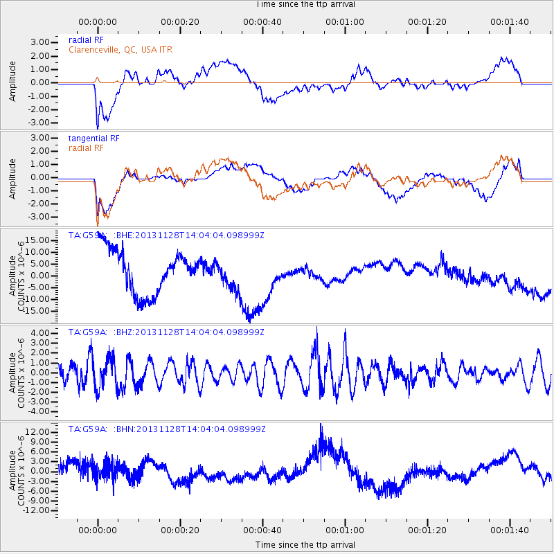
G59A Clarenceville, QC, USA - Earthquake Result Viewer
*The percent match for this event was below the threshold and hence no stack was calculated.
| Earthquake location: |
Southern Iran |
| Earthquake latitude/longitude: |
29.3/51.3 |
| Earthquake time(UTC): |
2013/11/28 (332) 13:51:34 GMT |
| Earthquake Depth: |
8.0 km |
| Earthquake Magnitude: |
5.8 MWB, 5.7 MWC |
| Earthquake Catalog/Contributor: |
NEIC PDE/NEIC COMCAT |
|
| Network: |
TA USArray Transportable Network (new EarthScope stations) |
| Station: |
G59A Clarenceville, QC, USA |
| Lat/Lon: |
45.08 N/73.18 W |
| Elevation: |
36 m |
|
| Distance: |
90.4 deg |
| Az: |
324.271 deg |
| Baz: |
46.038 deg |
| Ray Param: |
$rayparam |
*The percent match for this event was below the threshold and hence was not used in the summary stack. |
|
| Radial Match: |
34.782127 % |
| Radial Bump: |
400 |
| Transverse Match: |
37.06111 % |
| Transverse Bump: |
400 |
| SOD ConfigId: |
626651 |
| Insert Time: |
2014-04-19 21:47:39.343 +0000 |
| GWidth: |
2.5 |
| Max Bumps: |
400 |
| Tol: |
0.001 |
|
Signal To Noise
| Channel | StoN | STA | LTA |
| TA:G59A: :BHZ:20131128T14:04:04.098999Z | 1.3057472 | 1.5374465E-6 | 1.1774458E-6 |
| TA:G59A: :BHN:20131128T14:04:04.098999Z | 0.6422738 | 5.1759516E-6 | 8.058793E-6 |
| TA:G59A: :BHE:20131128T14:04:04.098999Z | 0.7581529 | 6.8169816E-6 | 8.991566E-6 |
| Arrivals |
| Ps | |
| PpPs | |
| PsPs/PpSs | |


