J61A Chester, VT, USA - Earthquake Result Viewer
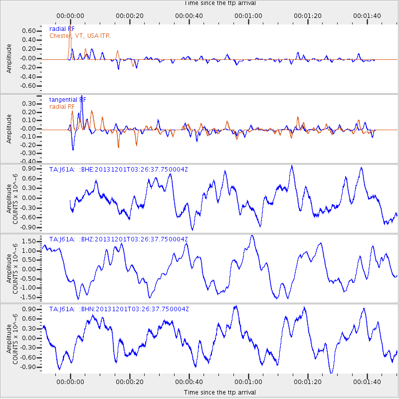
Earthquake location: Off Coast Of Northern California
Earthquake latitude/longitude: 41.7/-126.9
Earthquake time(UTC): 2013/12/01 (335) 03:19:38 GMT
Earthquake Depth: 10 km
Earthquake Magnitude: 5.5 MWW, 5.5 MW, 5.5 MW, 5.5 MWC, 5.5 MI, 5.5 MWR
Earthquake Catalog/Contributor: NEIC PDE/NEIC COMCAT
Network: TA USArray Transportable Network (new EarthScope stations)
Station: J61A Chester, VT, USA
Lat/Lon: 43.35 N/72.55 W
Elevation: 253 m
Distance: 39.5 deg
Az: 68.75 deg
Baz: 286.871 deg
Ray Param: 0.07495827
Estimated Moho Depth: 27.0 km
Estimated Crust Vp/Vs: 1.75
Assumed Crust Vp: 6.419 km/s
Estimated Crust Vs: 3.658 km/s
Estimated Crust Poisson's Ratio: 0.26
Radial Match: 88.933846 %
Radial Bump: 400
Transverse Match: 85.8531 %
Transverse Bump: 400
SOD ConfigId: 626651
Insert Time: 2014-04-19 22:17:41.395 +0000
GWidth: 2.5
Max Bumps: 400
Tol: 0.001

Signal To Noise

ChannelStoNSTALTA
TA:J61A: :BHZ:20131201T03:26:37.750004Z1.30479591.0333857E-67.919903E-7
TA:J61A: :BHN:20131201T03:26:37.750004Z1.1243753.9334782E-73.4983685E-7
TA:J61A: :BHE:20131201T03:26:37.750004Z2.23567755.6209325E-72.5141964E-7
Arrivals
Ps3.4 SECOND
PpPs11 SECOND
PsPs/PpSs14 SECOND