K48A Perry, MI, USA - Earthquake Result Viewer
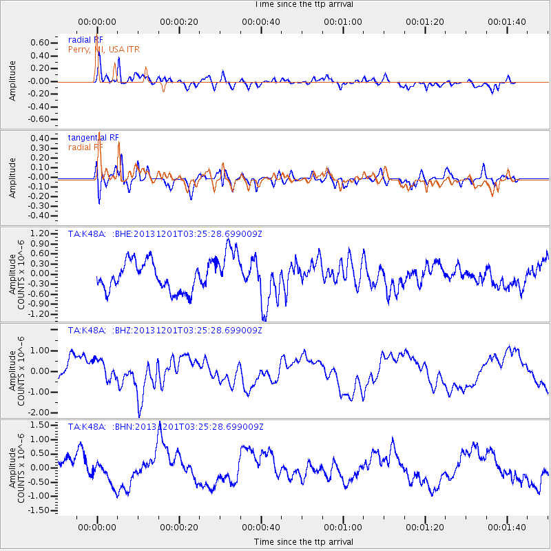
Earthquake location: Off Coast Of Northern California
Earthquake latitude/longitude: 41.7/-126.9
Earthquake time(UTC): 2013/12/01 (335) 03:19:38 GMT
Earthquake Depth: 10 km
Earthquake Magnitude: 5.5 MWW, 5.5 MW, 5.5 MW, 5.5 MWC, 5.5 MI, 5.5 MWR
Earthquake Catalog/Contributor: NEIC PDE/NEIC COMCAT
Network: TA USArray Transportable Network (new EarthScope stations)
Station: K48A Perry, MI, USA
Lat/Lon: 42.80 N/84.12 W
Elevation: 273 m
Distance: 31.4 deg
Az: 73.382 deg
Baz: 282.769 deg
Ray Param: 0.079071805
Estimated Moho Depth: 42.0 km
Estimated Crust Vp/Vs: 1.77
Assumed Crust Vp: 6.483 km/s
Estimated Crust Vs: 3.652 km/s
Estimated Crust Poisson's Ratio: 0.27
Radial Match: 83.10109 %
Radial Bump: 400
Transverse Match: 77.41439 %
Transverse Bump: 400
SOD ConfigId: 626651
Insert Time: 2014-04-19 22:17:48.758 +0000
GWidth: 2.5
Max Bumps: 400
Tol: 0.001

Signal To Noise

ChannelStoNSTALTA
TA:K48A: :BHZ:20131201T03:25:28.699009Z0.8010564.938489E-76.164973E-7
TA:K48A: :BHN:20131201T03:25:28.699009Z1.35740964.359905E-73.21193E-7
TA:K48A: :BHE:20131201T03:25:28.699009Z1.7616947.44608E-74.2266592E-7
Arrivals
Ps5.4 SECOND
PpPs17 SECOND
PsPs/PpSs22 SECOND