You are here: Home > Network List > TA - USArray Transportable Network (new EarthScope stations) Stations List
> Station P57A Homestead Farm, Martinsburg, WV, USA > Earthquake Result Viewer
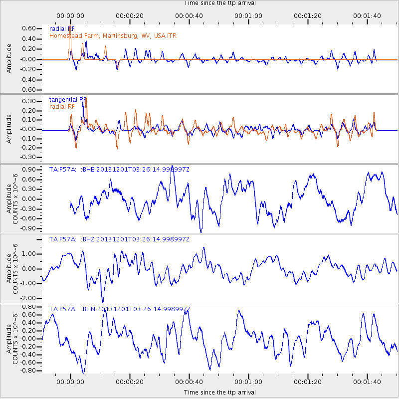
P57A Homestead Farm, Martinsburg, WV, USA - Earthquake Result Viewer
*The percent match for this event was below the threshold and hence no stack was calculated.
| Earthquake location: |
Off Coast Of Northern California |
| Earthquake latitude/longitude: |
41.7/-126.9 |
| Earthquake time(UTC): |
2013/12/01 (335) 03:19:38 GMT |
| Earthquake Depth: |
10 km |
| Earthquake Magnitude: |
5.5 MWW, 5.5 MW, 5.5 MW, 5.5 MWC, 5.5 MI, 5.5 MWR |
| Earthquake Catalog/Contributor: |
NEIC PDE/NEIC COMCAT |
|
| Network: |
TA USArray Transportable Network (new EarthScope stations) |
| Station: |
P57A Homestead Farm, Martinsburg, WV, USA |
| Lat/Lon: |
39.48 N/78.01 W |
| Elevation: |
191 m |
|
| Distance: |
36.8 deg |
| Az: |
76.764 deg |
| Baz: |
289.58 deg |
| Ray Param: |
$rayparam |
*The percent match for this event was below the threshold and hence was not used in the summary stack. |
|
| Radial Match: |
82.92264 % |
| Radial Bump: |
400 |
| Transverse Match: |
63.495636 % |
| Transverse Bump: |
400 |
| SOD ConfigId: |
626651 |
| Insert Time: |
2014-04-19 22:19:50.936 +0000 |
| GWidth: |
2.5 |
| Max Bumps: |
400 |
| Tol: |
0.001 |
|
Signal To Noise
| Channel | StoN | STA | LTA |
| TA:P57A: :BHZ:20131201T03:26:14.998997Z | 1.4759732 | 8.730819E-7 | 5.915296E-7 |
| TA:P57A: :BHN:20131201T03:26:14.998997Z | 1.5460085 | 5.7321324E-7 | 3.7076978E-7 |
| TA:P57A: :BHE:20131201T03:26:14.998997Z | 2.0426273 | 5.8290055E-7 | 2.8536803E-7 |
| Arrivals |
| Ps | |
| PpPs | |
| PsPs/PpSs | |


