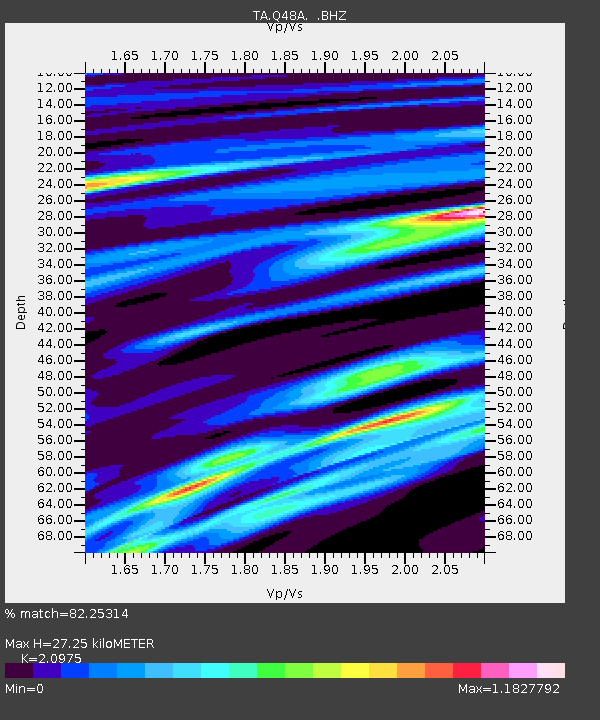
Q48A North Vernon, IN, USA - Earthquake Result Viewer
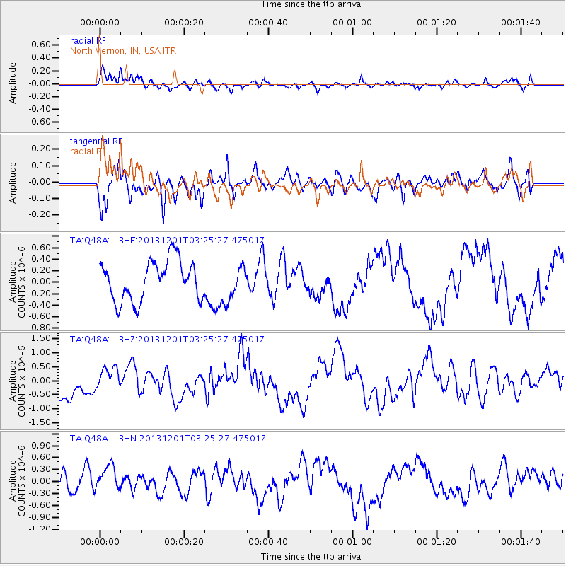
Earthquake location: Off Coast Of Northern California
Earthquake latitude/longitude: 41.7/-126.9
Earthquake time(UTC): 2013/12/01 (335) 03:19:38 GMT
Earthquake Depth: 10 km
Earthquake Magnitude: 5.5 MWW, 5.5 MW, 5.5 MW, 5.5 MWC, 5.5 MI, 5.5 MWR
Earthquake Catalog/Contributor: NEIC PDE/NEIC COMCAT
Network: TA USArray Transportable Network (new EarthScope stations)
Station: Q48A North Vernon, IN, USA
Lat/Lon: 38.93 N/85.73 W
Elevation: 185 m
Distance: 31.3 deg
Az: 81.18 deg
Baz: 288.38 deg
Ray Param: 0.07910827
Estimated Moho Depth: 27.25 km
Estimated Crust Vp/Vs: 2.10
Assumed Crust Vp: 6.498 km/s
Estimated Crust Vs: 3.098 km/s
Estimated Crust Poisson's Ratio: 0.35
Radial Match: 82.25314 %
Radial Bump: 400
Transverse Match: 64.72903 %
Transverse Bump: 400
SOD ConfigId: 626651
Insert Time: 2014-04-19 22:20:00.002 +0000
GWidth: 2.5
Max Bumps: 400
Tol: 0.001

Signal To Noise

ChannelStoNSTALTA
TA:Q48A: :BHZ:20131201T03:25:27.47501Z0.74880094.1439185E-75.534073E-7
TA:Q48A: :BHN:20131201T03:25:27.47501Z1.20977833.7542273E-73.1032357E-7
TA:Q48A: :BHE:20131201T03:25:27.47501Z0.868192553.0064012E-73.4628277E-7
Arrivals
Ps4.9 SECOND
PpPs12 SECOND
PsPs/PpSs17 SECOND